MyTopo
Kellogg Oregon US Topo Map
Couldn't load pickup availability
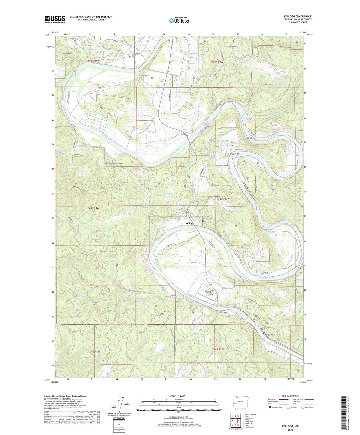
2023 topographic map quadrangle Kellogg in the state of Oregon. Scale: 1:24000. Based on the newly updated USGS 7.5' US Topo map series, this map is in the following counties: Douglas. The map contains contour data, water features, and other items you are used to seeing on USGS maps, but also has updated roads and other features. This is the next generation of topographic maps. Printed on high-quality waterproof paper with UV fade-resistant inks.
Quads adjacent to this one:
West: Old Blue
Northwest: Devils Graveyard
North: Elkton
Northeast: Putnam Valley
East: Yellow Butte
Southeast: Tyee Mountain
South: Tyee
Southwest: Kelly Butte
This map covers the same area as the classic USGS quad with code o43123e5.
Contains the following named places: Brads Creek, Cedar Creek, Center Bend Post Office, Deep Gulch, Dimmick Cemetery, Dwight Phipps State Forest Nursery, Elkton Airfield, Fitzpatrick Creek, Heddin Bluff, Heddin Creek, Hillside Post Office, Hutchinson State Park, Jones Bar, Kellogg, Kellogg Cemetery, Kellogg Grange, Kellogg Post Office, Kellogg Rural Fire Protection District, Madison County Wayside, Martin Creek, Maupin Bar, McGee Creek, Mehl Creek, Rattlesnake Gulch Reservoir, Smith Ferry, Smith Ferry Rapids, Tapp Creek, Umpqua RV Park Fly In Airport, Waggoner Creek, Wells Cemetery, Whitehorse Creek, Williams Creek