MyTopo
Yellow Butte Oregon US Topo Map
Couldn't load pickup availability
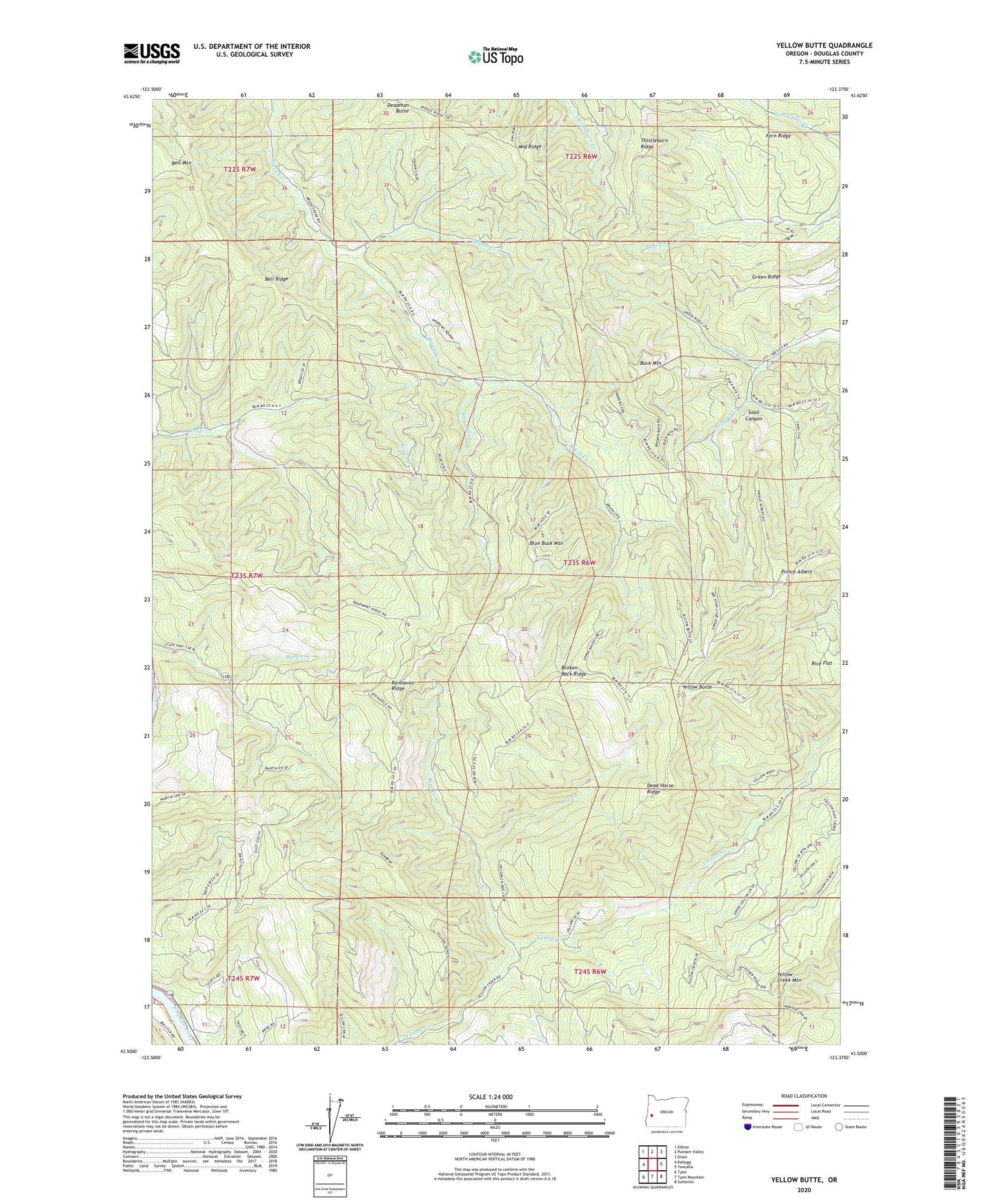
2024 topographic map quadrangle Yellow Butte in the state of Oregon. Scale: 1:24000. Based on the newly updated USGS 7.5' US Topo map series, this map is in the following counties: Douglas. The map contains contour data, water features, and other items you are used to seeing on USGS maps, but also has updated roads and other features. This is the next generation of topographic maps. Printed on high-quality waterproof paper with UV fade-resistant inks.
Quads adjacent to this one:
West: Kellogg
Northwest: Elkton
North: Putnam Valley
Northeast: Drain
East: Yoncalla
Southeast: Sutherlin
South: Tyee Mountain
Southwest: Tyee
This map covers the same area as the classic USGS quad with code o43123e4.
Contains the following named places: Bear Creek, Bell Mountain, Bell Ridge, Blue Buck Mountain, Blue Hole Creek, Broken Back Ridge, Buck Mountain, Dead Horse Ridge, Doe Creek, Fern Ridge, Green Ridge, Green Ridge Creek, Kellogg-Yoncalla Division, Middle Ridge, Prince Albert, Renhaven Ridge, Rice Flat, Snail Canyon, Squaw Creek, Yellow Butte, Yellow Creek County Park Boat Ramp