MyTopo
Kilchis River Oregon US Topo Map
Couldn't load pickup availability
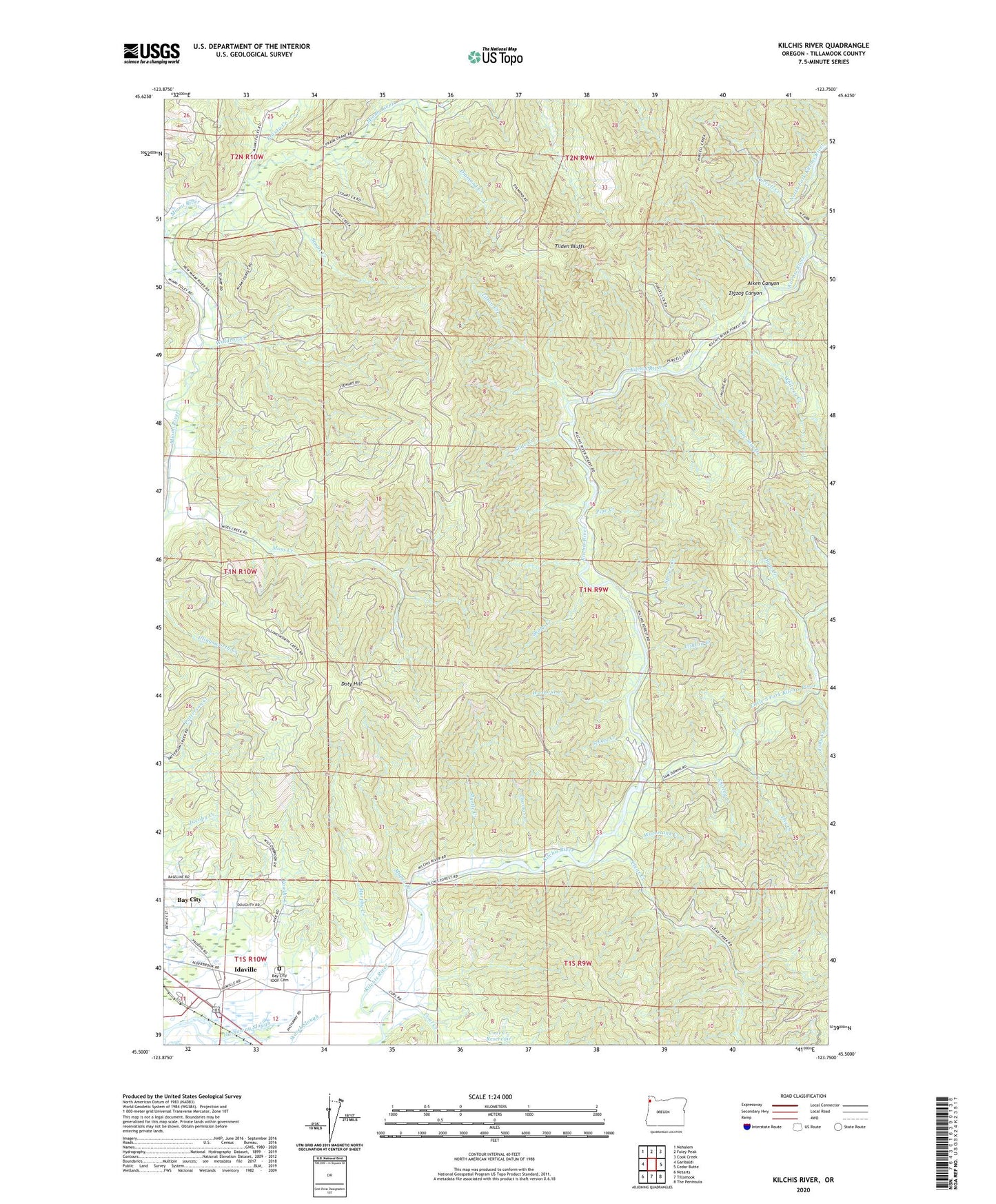
2020 topographic map quadrangle Kilchis River in the state of Oregon. Scale: 1:24000. Based on the newly updated USGS 7.5' US Topo map series, this map is in the following counties: Tillamook. The map contains contour data, water features, and other items you are used to seeing on USGS maps, but also has updated roads and other features. This is the next generation of topographic maps. Printed on high-quality waterproof paper with UV fade-resistant inks.
Quads adjacent to this one:
West: Garibaldi
Northwest: Nehalem
North: Foley Peak
Northeast: Cook Creek
East: Cedar Butte
Southeast: The Peninsula
South: Tillamook
Southwest: Netarts
Contains the following named places: Aiken Canyon, Averill Dairy, Bay City IOOF Cemetery, Blue Star Creek, Clear Creek, Clinton Creek, Coal Creek, Diamond Creek, Dietz Creek, Doty Hill, Gilmore Creek, Hathaway Slough, Idaville, Idaville Census Designated Place, Idaville Post Office, Iris Creek, Jody Creek, Kilchis River County Park, Kilchis River Park County Drift Boat Launch, Kilchis Valley Dairy, Little South Fork Kilchis River, Mapes Creek, Mapes Creek County Drift Boat Launch, Minich Creek, Moss Creek, Murphy Creek, Myrtle Creek, North Fork Kilchis River, Pipe Creek, Prouty Creek, Purcell Creek, Riverdale Post Office, Riverdale School, Roller Creek, Sam Downs Creek, School Creek, Sharp Creek, Shirley Creek, Slide Creek, South Fork Kilchis River, Spruce Creek, Stuart Creek, Thomas Creek, Tilden Bluffs, Tilton Creek, Turning Point Dairy, Vaughn Creek, Waldron Creek, Washout Creek, Watertank Creek, Whitney Creek, Zigzag Canyon