MyTopo
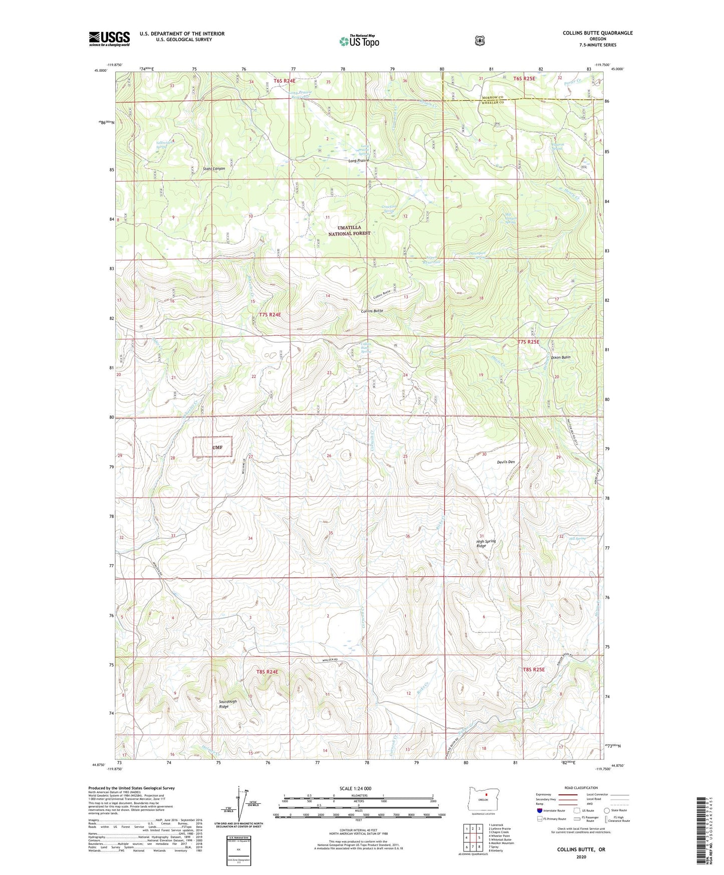
Collins Butte Oregon US Topo Map
Couldn't load pickup availability
Also explore the Collins Butte Forest Service Topo of this same quad for updated USFS data
2023 topographic map quadrangle Collins Butte in the state of Oregon. Scale: 1:24000. Based on the newly updated USGS 7.5' US Topo map series, this map is in the following counties: Wheeler, Morrow. The map contains contour data, water features, and other items you are used to seeing on USGS maps, but also has updated roads and other features. This is the next generation of topographic maps. Printed on high-quality waterproof paper with UV fade-resistant inks.
Quads adjacent to this one:
West: Wheeler Point
Northwest: Lonerock
North: Lefevre Prairie
Northeast: Chapin Creek
East: Whitetail Butte
Southeast: Kimberly
South: Spray
Southwest: Masiker Mountain
This map covers the same area as the classic USGS quad with code o44119h7.
Contains the following named places: Aspen Reservoir, Collins Butte, Collins Butte Spring, Corncob Ranch, Crawford Creek, Crawford Spring, Davenport Spring, Davis Creek, Devils Den, Dixon Basin, Flatiron Spring, Henry Creek, High Spring Ridge, Hill Spring, Long Prairie, Long Prairie Reservoir, Long Prairie Spring, Mill Canyon Spring, Ricks Creek, Yellowjacket Spring