MyTopo
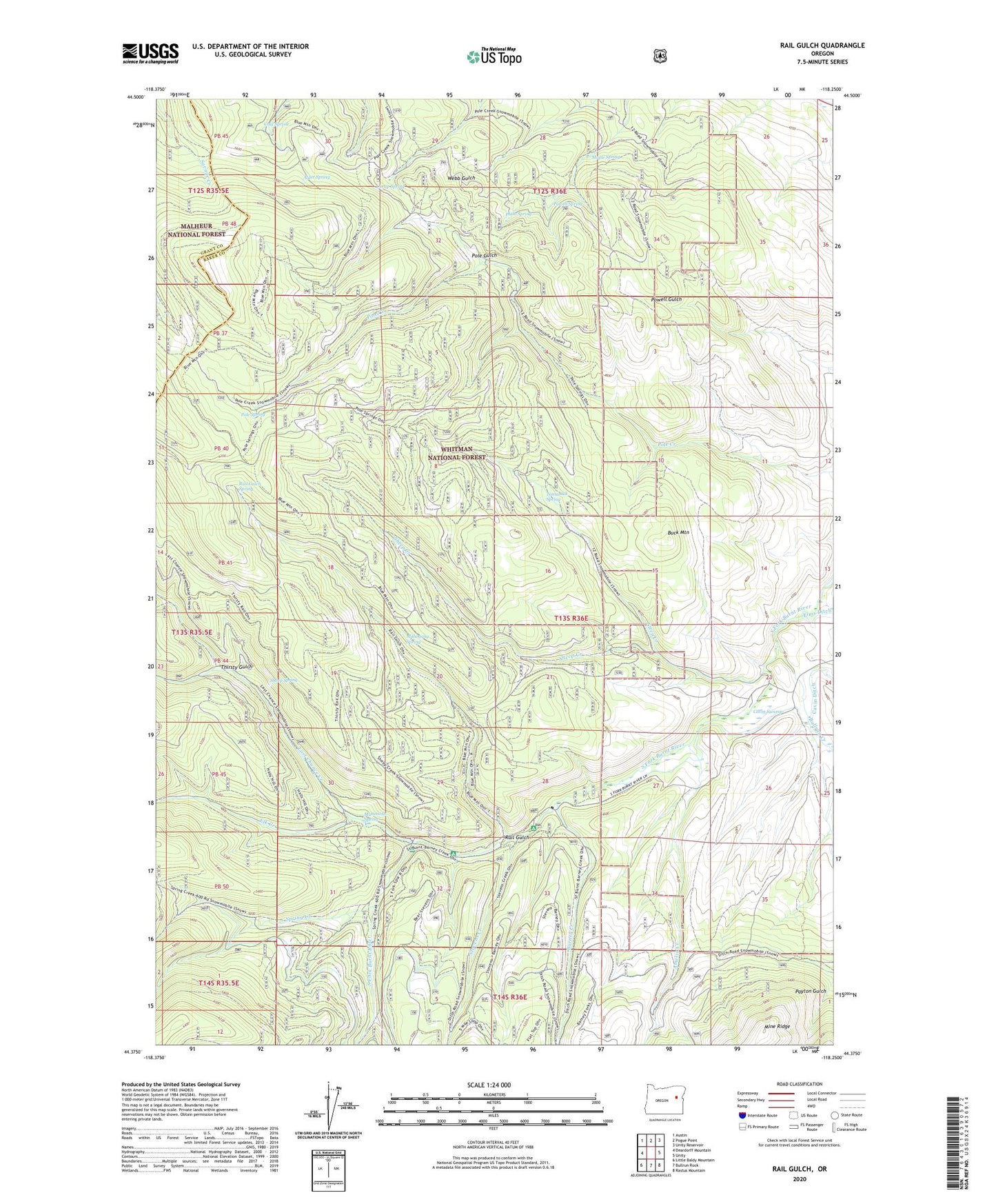
Rail Gulch Oregon US Topo Map
Couldn't load pickup availability
Also explore the Rail Gulch Forest Service Topo of this same quad for updated USFS data
2023 topographic map quadrangle Rail Gulch in the state of Oregon. Scale: 1:24000. Based on the newly updated USGS 7.5' US Topo map series, this map is in the following counties: Baker, Grant. The map contains contour data, water features, and other items you are used to seeing on USGS maps, but also has updated roads and other features. This is the next generation of topographic maps. Printed on high-quality waterproof paper with UV fade-resistant inks.
Quads adjacent to this one:
West: Deardorff Mountain
Northwest: Austin
North: Pogue Point
Northeast: Unity Reservoir
East: Unity
Southeast: Rastus Mountain
South: Bullrun Rock
Southwest: Little Baldy Mountain
This map covers the same area as the classic USGS quad with code o44118d3.
Contains the following named places: Alder Spring, Amelia Creek, Barney Creek, Bear Creek, Buck Mountain, Bullrun Creek, Bullrun Mine, Cavin Ditch, Cavin Swamp, Cold Spring, Curup Spring, Eldorado Ditch, Elk Creek, Elk Creek Recreation Site, Last Chance Creek, Mahogany Spring, Mammoth Spring, Mammoth Spring Recreation Site, Maple Spring, Orion Mine, Pluto Spring, Pole Gulch, Pole Spring, Powell Spring, Rail Gulch, Rail Gulch Spring, Sheep Creek, Sheep Spring, South Fork Recreation Site, Spring Creek, Steep Creek, Stevens Creek, Stevens Creek Recreation Site, Tamarack Spring, Tamarack Spring Campground, Thirsty Gulch