MyTopo
Antone Oregon US Topo Map
Couldn't load pickup availability
Also explore the Antone Forest Service Topo of this same quad for updated USFS data
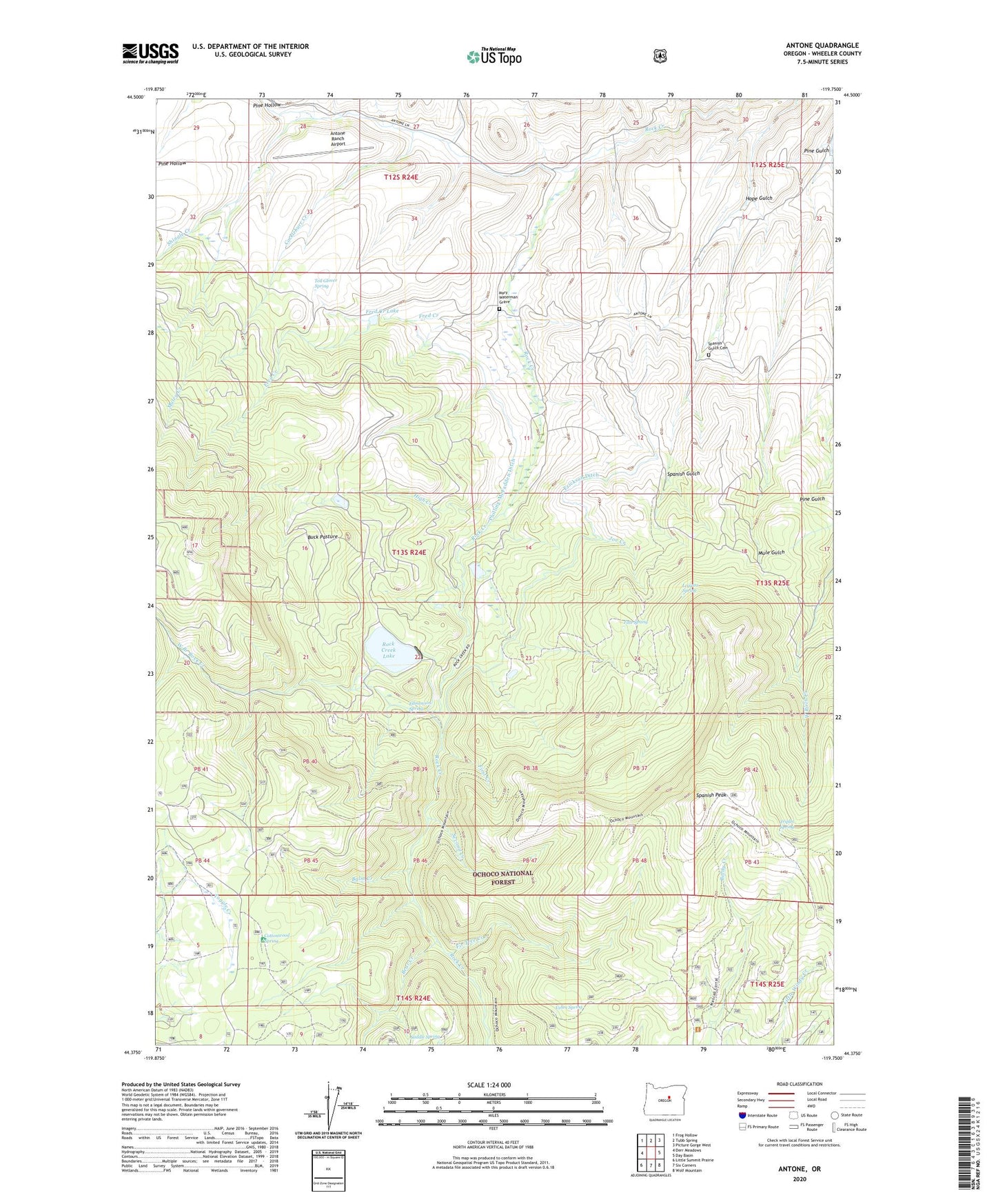
2024 topographic map quadrangle Antone in the state of Oregon. Scale: 1:24000. Based on the newly updated USGS 7.5' US Topo map series, this map is in the following counties: Wheeler. The map contains contour data, water features, and other items you are used to seeing on USGS maps, but also has updated roads and other features. This is the next generation of topographic maps. Printed on high-quality waterproof paper with UV fade-resistant inks.
Quads adjacent to this one:
West: Derr Meadows
Northwest: Frog Hollow
North: Tubb Spring
Northeast: Picture Gorge West
East: Day Basin
Southeast: Wolf Mountain
South: Six Corners
Southwest: Little Summit Prairie
This map covers the same area as the classic USGS quad with code o44119d7.
Contains the following named places: Andrews Mine, Antone, Antone Post Office, Antone Ranch Airport, Balm Creek, Bear Creek, Buck Pasture, Cockleburr Creek, Cottonwood Recreation Site, Cottonwood Spring, Edmonson Spring, Erickson Ditch, Erickson Ranch, Fir Tree Creek, First Creek, Fred Creek, Fred Creek Lake, High Creek, Hope Gulch, Joe Creek, Leggins Spring, Maley Creek, Mary Waterman Grave, Mascall Corralls, Nelson Place, Philling-McFadden Ditch, Pine Gulch, Pine Hollow, Rock Creek Lake, Rock Creek Lake Dam, Saddle Spring, Second Creek, Shingle Creek, Spanish Gulch Cemetery, Spanish Peak, Tate Spring, Ted Glover Spring, Triplet Spring, Vehrs Spring, Waterman Mine, West Branch Rock Creek