MyTopo
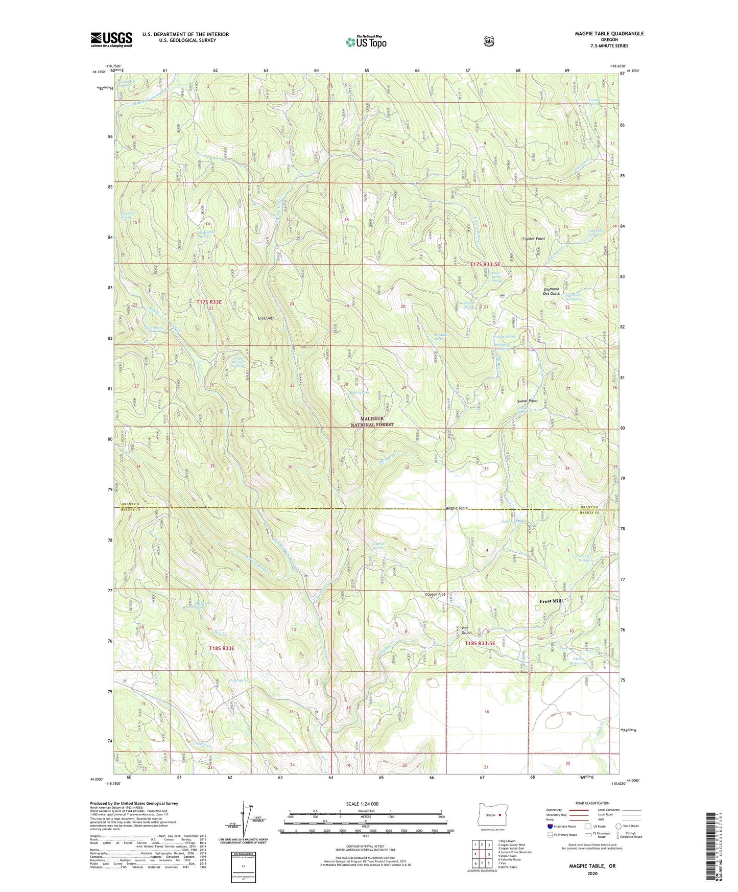
Magpie Table Oregon US Topo Map
Couldn't load pickup availability
Also explore the Magpie Table Forest Service Topo of this same quad for updated USFS data
2024 topographic map quadrangle Magpie Table in the state of Oregon. Scale: 1:24000. Based on the newly updated USGS 7.5' US Topo map series, this map is in the following counties: Grant, Harney. The map contains contour data, water features, and other items you are used to seeing on USGS maps, but also has updated roads and other features. This is the next generation of topographic maps. Printed on high-quality waterproof paper with UV fade-resistant inks.
Quads adjacent to this one:
West: Jump-off Joe Mountain
Northwest: Big Canyon
North: Logan Valley West
Northeast: Logan Valley East
East: Dollar Basin
Southeast: Moffit Table
South: Van
Southwest: Calamity Butte
This map covers the same area as the classic USGS quad with code o44118a6.
Contains the following named places: Bedrock Spring, Buck Spring, Calo Spring, Cap Box Spring, Cougar Flat, Dead Horse Spring, Diamond Dot Spring, Dry Creek, Dry Creek Spring, East Fork Wolf Creek, Elk Wallow Spring, Frazier Point, Frazier Point Fire Lookout, Frazier Spring, Frost Mill, Gabe Spring, Glass Mountain, Glass Mountain Spring, Hart Ranch, Loperfido Spring, Lucky Reservoir, Magpie Creek, Magpie Spring, Magpie Table, Mahogany Spring, McMullen Spring, Middle Fork Wolf Creek, Pierpont Spring, Simonetti Spring, Squaw Creek, Sweat Point, Tuhu-u Spring, Tureman Spring, Van Gulch, Van Gulch Spring, West Fork Wolf Creek