MyTopo
China Cap Oregon US Topo Map
Couldn't load pickup availability
Also explore the China Cap Forest Service Topo of this same quad for updated USFS data
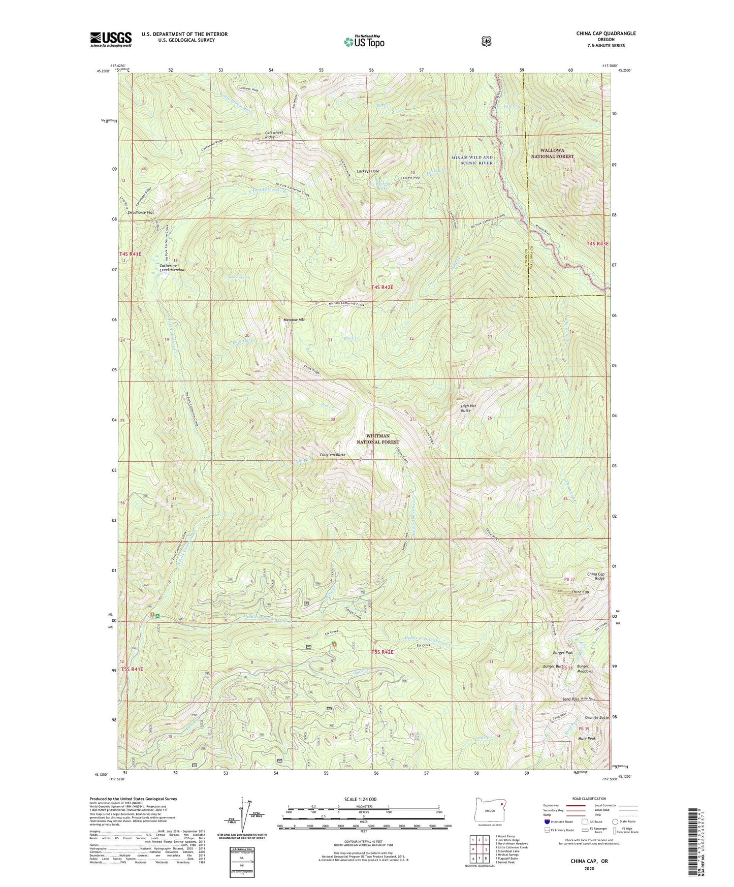
2024 topographic map quadrangle China Cap in the state of Oregon. Scale: 1:24000. Based on the newly updated USGS 7.5' US Topo map series, this map is in the following counties: Union, Wallowa. The map contains contour data, water features, and other items you are used to seeing on USGS maps, but also has updated roads and other features. This is the next generation of topographic maps. Printed on high-quality waterproof paper with UV fade-resistant inks.
Quads adjacent to this one:
West: Little Catherine Creek
Northwest: Mount Fanny
North: Jim White Ridge
Northeast: North Minam Meadows
East: Steamboat Lake
Southeast: Bennet Peak
South: Flagstaff Butte
Southwest: Medical Springs
This map covers the same area as the classic USGS quad with code o45117b5.
Contains the following named places: Amelia Spring, Big Minam Guard Station, Boot Hill Creek, Buck Creek Recreation Site, Buck Creek Trailhead, Burger Butte, Burger Meadows, Burger Pass, Cartwheel Ridge, Catherine Creek Cabin, Catherine Creek Meadow, China Cap, China Cap Creek, China Cap Ridge, Chop Creek, Cuuy'em Butte, Deadhorse Flat, Granite Butte, High Hat Butte, Jim Creek, Lackey Creek, Lackeys Hole, Lackeys Lake, Meadow Mountain, Middle Fork Catherine Creek, Mitaat Hiweelece Creek, Mule Peak, North Fork Catherine Creek Recreation Site, North Fork Picnic Area, Pole Creek, Pot Creek, Rock Creek, Sand Pass, Spring Creek