MyTopo
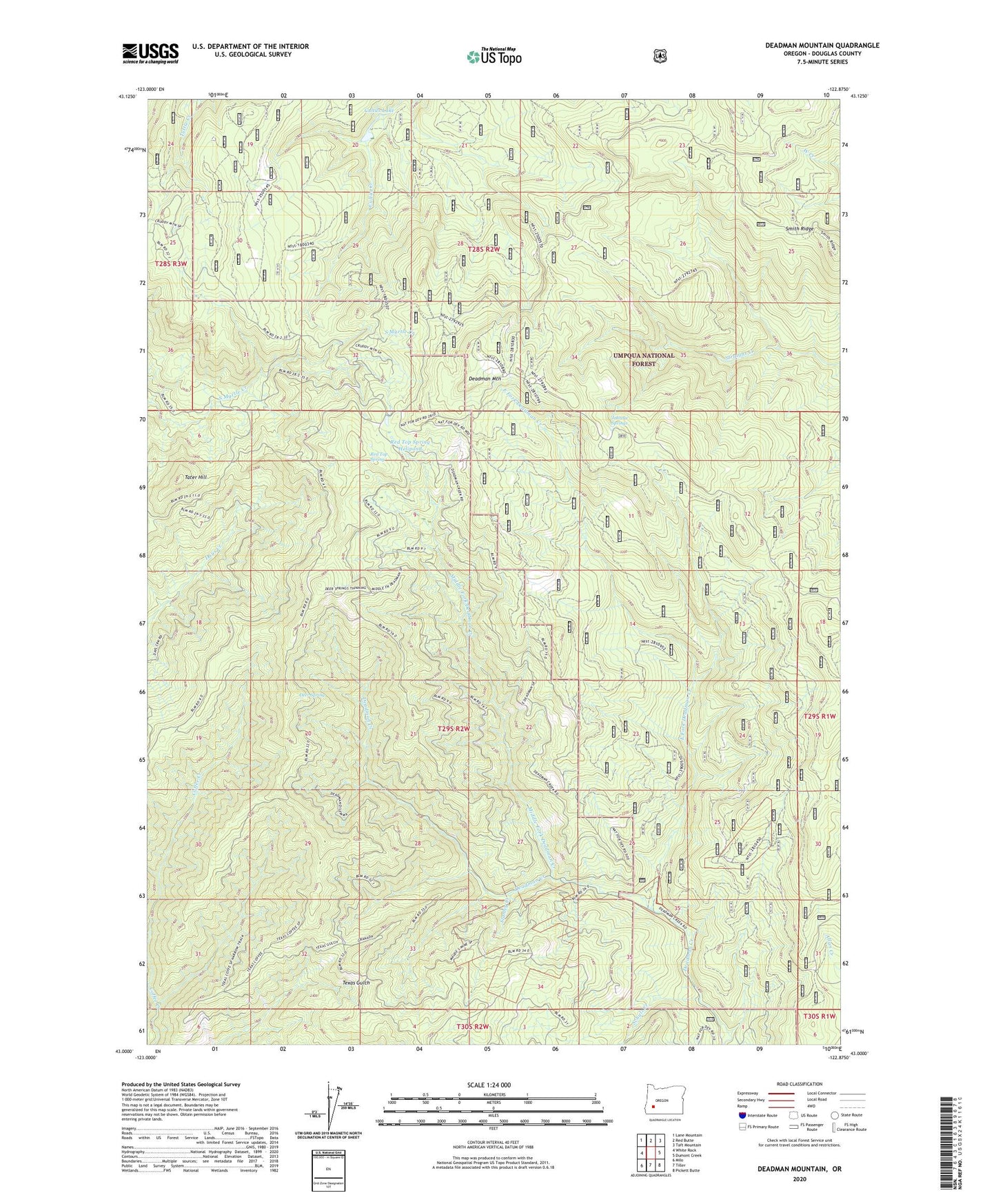
Deadman Mountain Oregon US Topo Map
Couldn't load pickup availability
Also explore the Deadman Mountain Forest Service Topo of this same quad for updated USFS data
2023 topographic map quadrangle Deadman Mountain in the state of Oregon. Scale: 1:24000. Based on the newly updated USGS 7.5' US Topo map series, this map is in the following counties: Douglas. The map contains contour data, water features, and other items you are used to seeing on USGS maps, but also has updated roads and other features. This is the next generation of topographic maps. Printed on high-quality waterproof paper with UV fade-resistant inks.
Quads adjacent to this one:
West: White Rock
Northwest: Lane Mountain
North: Red Butte
Northeast: Taft Mountain
East: Dumont Creek
Southeast: Pickett Butte
South: Tiller
Southwest: Milo
This map covers the same area as the classic USGS quad with code o43122a8.
Contains the following named places: Cow Creek Reservation, Cultus Lake, Deadman Mountain, Deer Spring, East Fork Deadman Creek, Johnnie Springs, Maude- S Mine, Middle Fork Deadman Creek, Red Top Spring, Red Top Spring Helipond, Schulz Creek, Smith Ridge, Stanley Creek, Tater Hill, Umpqua Mine, Windy Camp, Windy Camp Lookout