MyTopo
Pendleton Oregon US Topo Map
Couldn't load pickup availability
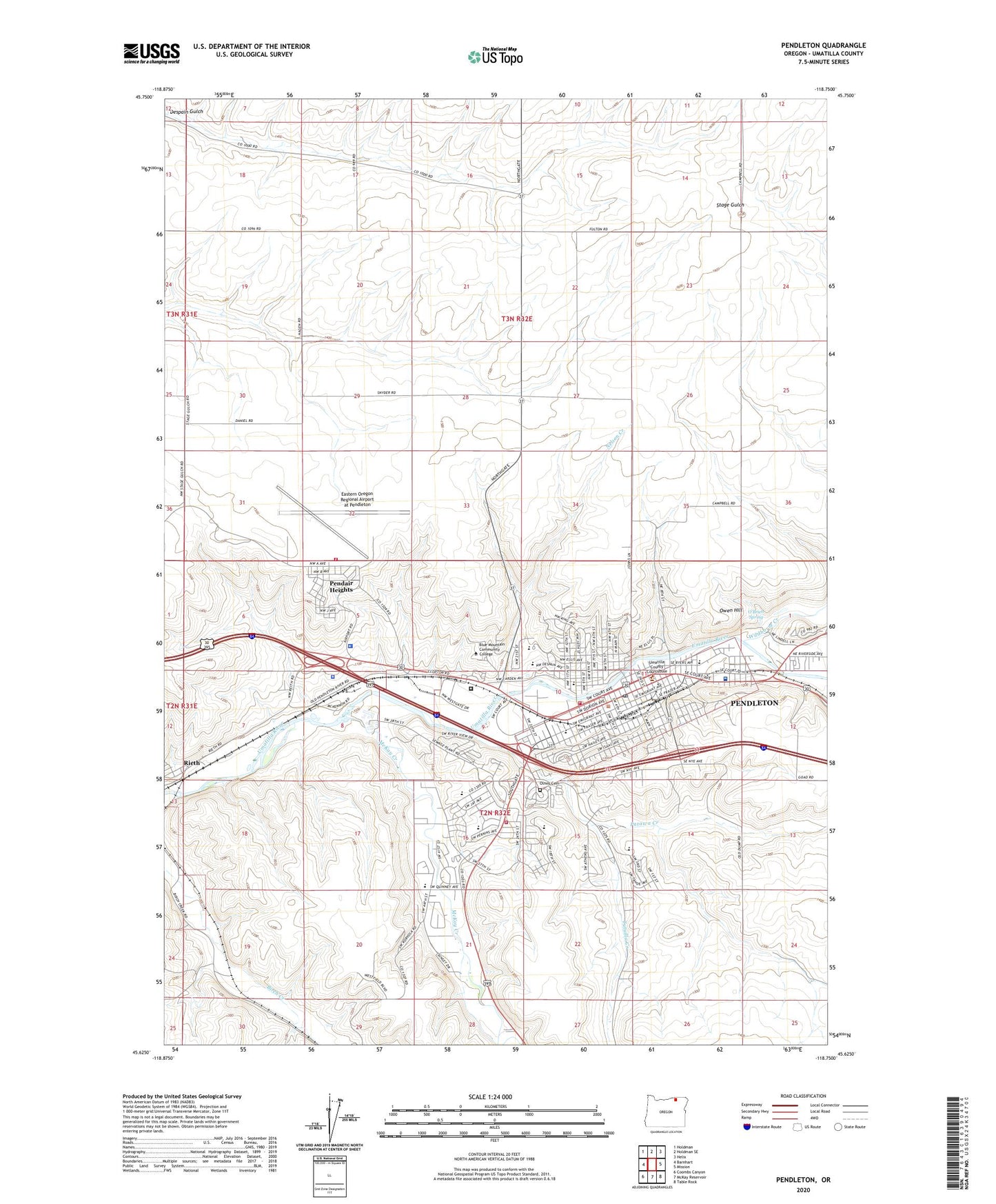
2024 topographic map quadrangle Pendleton in the state of Oregon. Scale: 1:24000. Based on the newly updated USGS 7.5' US Topo map series, this map is in the following counties: Umatilla. The map contains contour data, water features, and other items you are used to seeing on USGS maps, but also has updated roads and other features. This is the next generation of topographic maps. Printed on high-quality waterproof paper with UV fade-resistant inks.
Quads adjacent to this one:
West: Barnhart
Northwest: Holdman
North: Holdman SE
Northeast: Helix
East: Mission
Southeast: Table Rock
South: McKay Reservoir
Southwest: Coombs Canyon
This map covers the same area as the classic USGS quad with code o45118f7.
Contains the following named places: Aldrich Park, American Red Cross Northeast Oregon District Pendleton Office, Blue Mountain Community College, Blue Mountain Community College Bob Clapp Memorial Theatre, Blue Mountain Community College Library, Blue Mountain Recovery Center, Centennial Park, Children's Museum of Eastern Oregon, City of Pendleton, Department of Motor Vehicles Pendleton, Eastern Oregon Alcoholism Foundation Treatment Facility, Eastern Oregon Correctional Institution, Eastern Oregon Regional Airport at Pendleton, Fallen Field, Glendale, Grecian Heights Park, Harris Junior Academy, Heritage Station The Umatilla County Museum, InterMountain Education Service District, Kiwanis Park, KRBM-FM, KTIX-AM, Lincoln Primary School, May Park, McCune Junior High School, McKay Creek, McKay Creek Elementary School, McKay School Park, Murray Junior High School, Nelson Creek, O'Brien Spring, Olney Cemetery, Oregon State Police Department Pendleton, Owen Hill, Patawa Creek, Pendair, Pendair Heights, Pendair Park, Pendleton, Pendleton Academies, Pendleton City Fire and Ambulance Station 1, Pendleton City Fire and Ambulance Station 2, Pendleton City Fire and Ambulance Station 3 Airport, Pendleton City Hall, Pendleton City Police Department, Pendleton Community Hospital Helipad, Pendleton Community Park, Pendleton Convention Center, Pendleton Education Center, Pendleton Field Post Office, Pendleton Greyhound Bus Station, Pendleton High School, Pendleton Junction, Pendleton Municipal Court, Pendleton Post Office, Pendleton Public Library, Pendleton Public Works Department, Pendleton Ranger Station, Pendleton Round - Up and Happy Canyon Hall of Fame, Pendleton Wastewater Treatment Facility, Pendleton Water Treatment Facility, Pilot Rock Junction, Pioneer Park, Rice-Blakey Park, Rieth, Rieth Post Office, River Parkway, Roy Raley Park, Saint Anthony Hospital, Saint Anthony Hospital Heliport, Sergeant City Park, Sherwood Heights Elementary School, Sherwood Park, Stillman Park, Sunridge Middle School, The Pendleton Round - Up Rodeo Grounds, Till Taylor Park, Tutuilla Creek, Umatilla County Courthouse, Umatilla County Juvenile Center, Umatilla County Public Health Division Office, Umatilla County Public Works, Umatilla County Sheriff's Office Pendleton, Umatilla County Sheriff's Office Pendleton Courthouse, Umatilla National Forest Headquarters, Vert Auditorium / Vert Little Theater, Vincent Park, Washington Elementary School, West Hills Intermediate, Wildhorse Creek, ZIP Code: 97801