MyTopo
McKay Reservoir Oregon US Topo Map
Couldn't load pickup availability
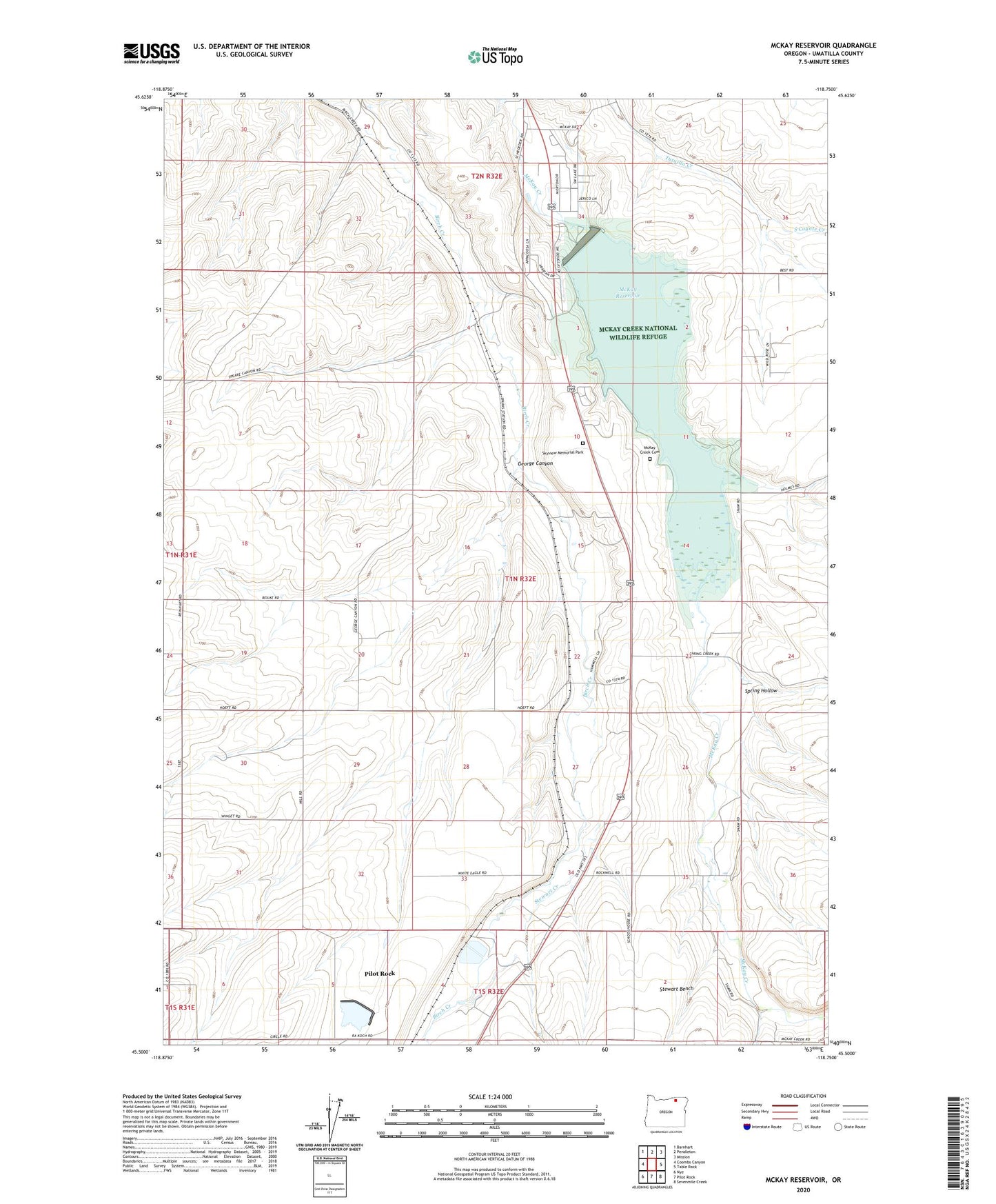
2024 topographic map quadrangle McKay Reservoir in the state of Oregon. Scale: 1:24000. Based on the newly updated USGS 7.5' US Topo map series, this map is in the following counties: Umatilla. The map contains contour data, water features, and other items you are used to seeing on USGS maps, but also has updated roads and other features. This is the next generation of topographic maps. Printed on high-quality waterproof paper with UV fade-resistant inks.
Quads adjacent to this one:
West: Coombs Canyon
Northwest: Barnhart
North: Pendleton
Northeast: Mission
East: Table Rock
Southeast: Sevenmile Creek
South: Pilot Rock
Southwest: Nye
This map covers the same area as the classic USGS quad with code o45118e7.
Contains the following named places: Birch Siding, City of Pilot Rock, George Canyon, Green Meadows, Green Meadows Census Designated Place, Horne Airfield, Lens, Little McKay Creek, McKay Creek Cemetery, McKay Creek National Wildlife Refuge, McKay Creek North Boat Ramp, McKay Dam, McKay Dam Post Office, McKay Reservoir, New Pass, Oregon Fibre Products Dam Number One, Pendleton Country Club, Pilot Rock Wastewater Treatment Plant, Salisbury Post Office, Skyview Memorial Park, South Coyote Creek, Sparks, Spring Hollow, Stewart Bench, Stewart Creek, White Eagle Grange Hall