MyTopo
Mount Ireland Oregon US Topo Map
Couldn't load pickup availability
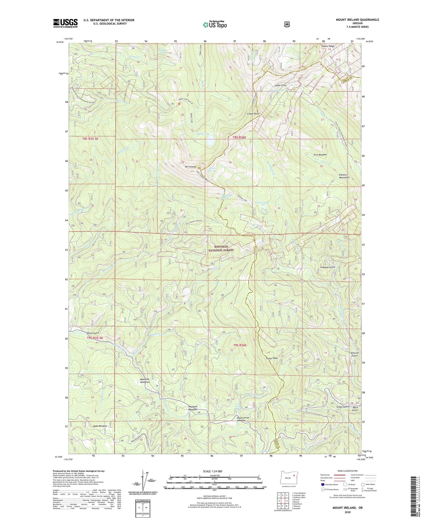
2020 topographic map quadrangle Mount Ireland in the state of Oregon. Scale: 1:24000. Based on the newly updated USGS 7.5' US Topo map series, this map is in the following counties: Grant, Baker. The map contains contour data, water features, and other items you are used to seeing on USGS maps, but also has updated roads and other features. This is the next generation of topographic maps. Printed on high-quality waterproof paper with UV fade-resistant inks.
Quads adjacent to this one:
West: Granite
Northwest: Trout Meadows
North: Crawfish Lake
Northeast: Anthony Lakes
East: Bourne
Southeast: Sumpter
South: Whitney
Southwest: Greenhorn
Contains the following named places: Bald Mountain Mine, Baldy Lake, Beagle Creek, Bear Meadow, Belle of Baker Mine, Big Dipper Spring, Blue Springs Summit Sno-Park, Boundary Creek, Boundary Creek Forest Service Station, Bubbling Spring, Buck Gulch Mine, Buckhorn Mine, Cable Cove, Cableville, Cableville Post Office, California Mine, Cap Martin Mine, Channel Creek, Crown Point, Crown Point Mine, Deep Creek, Downie Lake, East Fork Boundary Creek, Elk Heaven Mine, Elstow Post Office, Erin Creek, Erin Meadow, Gold Bug-Grizzly Mine, Gold Center, Gold Center Meadow, Gold Center Spring, Grand Central Mine, Grand Trunk Mine, Grays Gulch, Grays Peak, Griffith Placer, Haystack Meadows, Heedie Spring, Herculean Mine, Ibex Mine, Imperial Eagle Mine, Ireland Spring, Ivy May Mine, Kane Creek, Last Chance Mine, Lead Lode Mine, Little Buck Creek, Mahoney Meadows, Maidens Dream Mine, Mammoth Mine, Mile High Mine, Monumental Mine, Mormon Boy Mine, Mount Ireland, O'Farrel Gulch, Onion Gulch, Ophir Mine, Oregon Chief Mine, Red Chief Mine, Rob Roy Mine, Sloans Ridge, Sunnybrook Mine, Swamp Creek, Umpqua Gulch, Uncle Sam Mine, Weaver Placer, West Fork Boundary Creek