MyTopo
Whitney Oregon US Topo Map
Couldn't load pickup availability
Also explore the Whitney Forest Service Topo of this same quad for updated USFS data
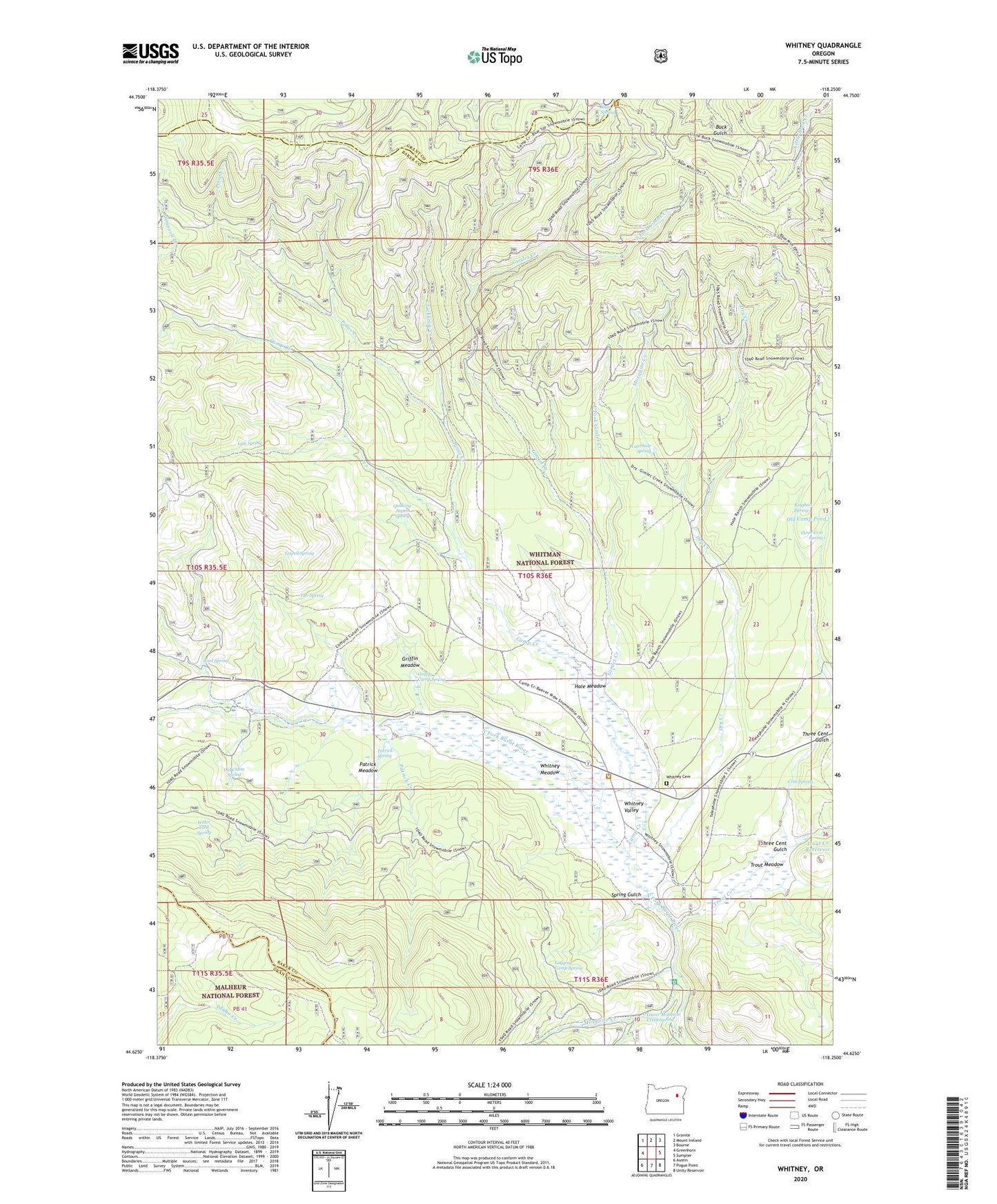
2024 topographic map quadrangle Whitney in the state of Oregon. Scale: 1:24000. Based on the newly updated USGS 7.5' US Topo map series, this map is in the following counties: Baker, Grant. The map contains contour data, water features, and other items you are used to seeing on USGS maps, but also has updated roads and other features. This is the next generation of topographic maps. Printed on high-quality waterproof paper with UV fade-resistant inks.
Quads adjacent to this one:
West: Greenhorn
Northwest: Granite
North: Mount Ireland
Northeast: Bourne
East: Sumpter
Southeast: Unity Reservoir
South: Pogue Point
Southwest: Austin
This map covers the same area as the classic USGS quad with code o44118f3.
Contains the following named places: Antlers Recreation Site, Blue Spring, C and H Riders Camp, Camp Creek, Carroll, Clifford, Clifford Post Office, Corey and Meadow Placer, Cree Spring, Dry Creek, Earl Spring, East Fork Gimlet Creek, Gimlet, Gimlet Creek, Griffin Camp Spring, Griffin Meadow, Hale Meadow, Hale Ranch, Jackknife Creek, Kingbolt Spring, Logging Camp Spring, Lowell Spring, Lower Mosquito Creek Spring, Lyle Spring, Middle Fork Dry Creek, Mosquito Creek, Old Cabin Spring, Old Camp Pond, Parkers, Patrick Creek, Patrick Meadow, Patrick Spring, Pinus Creek, Quaking Aspen Spring, Ranes & Borger Mine, South Fork Gimlet Creek, South Fork Mosquito Creek, Spring Gulch, Three Cent Gulch, Three Cent Spring, Trout Creek, Trout Creek Reservoir, Trout Meadow, Tub Spring, Walker Ranch, Water Tank Spring, Waterhole Spring, Whitney, Whitney Cemetery, Whitney Meadow, Whitney Post Office, Whitney Valley