MyTopo
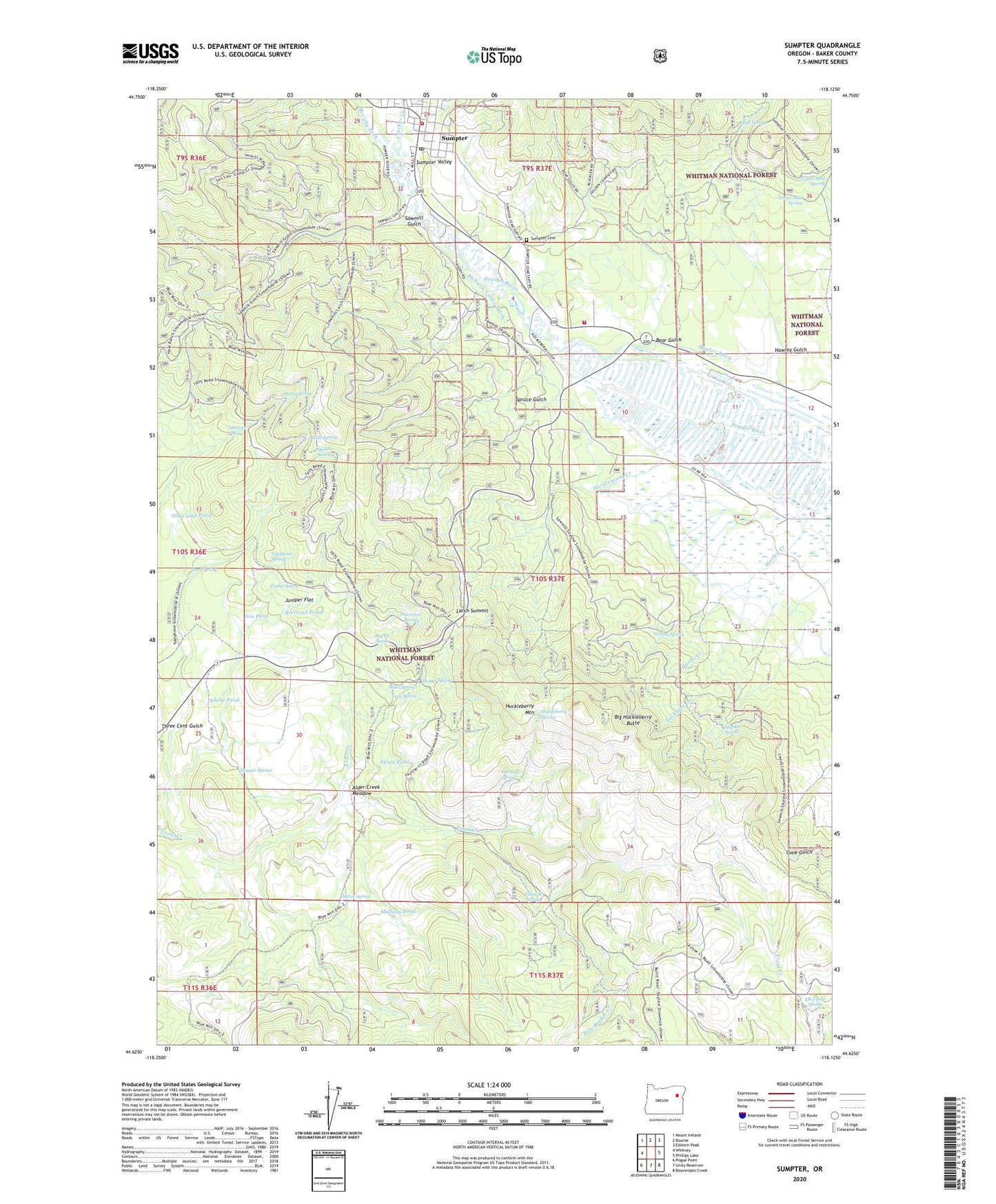
Sumpter Oregon US Topo Map
Couldn't load pickup availability
Also explore the Sumpter Forest Service Topo of this same quad for updated USFS data
2024 topographic map quadrangle Sumpter in the state of Oregon. Scale: 1:24000. Based on the newly updated USGS 7.5' US Topo map series, this map is in the following counties: Baker. The map contains contour data, water features, and other items you are used to seeing on USGS maps, but also has updated roads and other features. This is the next generation of topographic maps. Printed on high-quality waterproof paper with UV fade-resistant inks.
Quads adjacent to this one:
West: Whitney
Northwest: Mount Ireland
North: Bourne
Northeast: Elkhorn Peak
East: Phillips Lake
Southeast: Beaverdam Creek
South: Unity Reservoir
Southwest: Pogue Point
This map covers the same area as the classic USGS quad with code o44118f2.
Contains the following named places: Adobe Pond, Alder Creek, Alder Creek Meadow, Alder Spring, Alder Springs, Antelope Spring, Baker County Library Sumpter Branch Library, Bear Gulch, Big Fir Spring, Big Huckleberry Butte, Camp Spring, City of Sumpter, Cracker Creek, Cracker Creek Museum of Mining, Earmuff Spring, Elk Camp Spring, Harris Creek, Hawley Ditch, Hawley Gulch, Huckleberry Creek, Huckleberry Mountain, Huckleberry Spring, Huff Spring, Iris Pond, Juniper Flat, Justus Spring, Larch, Larch Summit, Lockhart Creek, Lower Mud Spring, Maggie Spring, McCully Fork, McEwen Valley Ditch, Metsker Spring, Midway Pond, Morin Spring, Morris Spring, Pole Bridge Creek, Powder River Rural Fire Department - Mosquito Flat Fire Station, Powerline Spring, Railroad Pond, Reed Spring, Sawmill Gulch, Slide Spring, South Wye, Spruce Gulch, Stickler Spring, Sumpter, Sumpter Cemetery, Sumpter City Hall, Sumpter Post Office, Sumpter Utilities Manager Office, Sumpter Valley Gold Dredge Museum, Sumpter Volunteer Fire Department, Sumpter Wastewater Treatment Lagoon, Swale Pond, Telephone Spring, Three M Spring, Tuck Spring, Upper Mud Spring, Worley Creek, Worley Spring