MyTopo
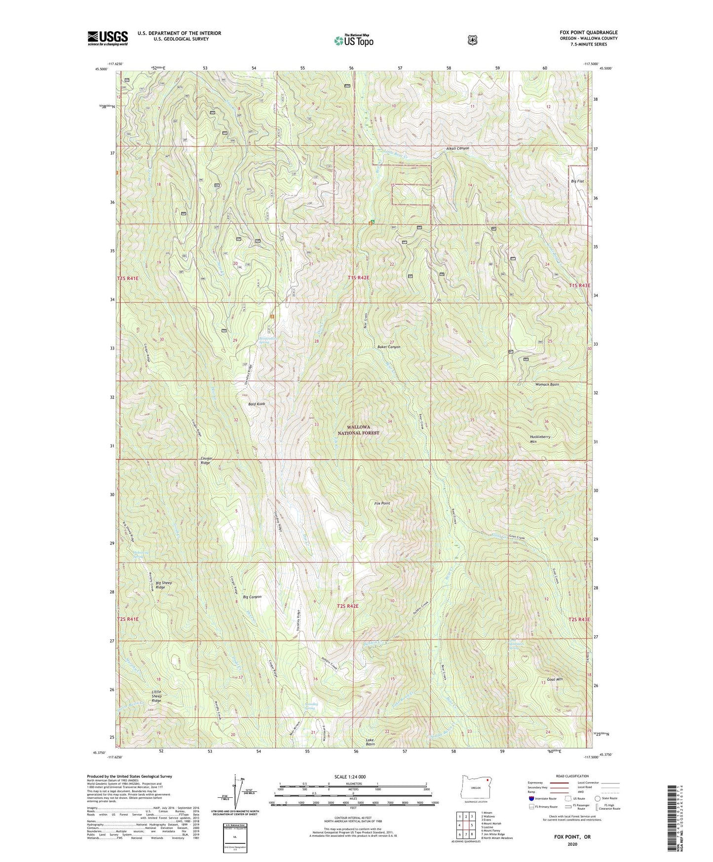
Fox Point Oregon US Topo Map
Couldn't load pickup availability
Also explore the Fox Point Forest Service Topo of this same quad for updated USFS data
2023 topographic map quadrangle Fox Point in the state of Oregon. Scale: 1:24000. Based on the newly updated USGS 7.5' US Topo map series, this map is in the following counties: Wallowa. The map contains contour data, water features, and other items you are used to seeing on USGS maps, but also has updated roads and other features. This is the next generation of topographic maps. Printed on high-quality waterproof paper with UV fade-resistant inks.
Quads adjacent to this one:
West: Mount Moriah
Northwest: Minam
North: Wallowa
Northeast: Evans
East: Lostine
Southeast: North Minam Meadows
South: Jim White Ridge
Southwest: Mount Fanny
This map covers the same area as the classic USGS quad with code o45117d5.
Contains the following named places: Alkali Canyon, Baker Canyon, Bald Knob, Bear Creek Guard Station, Bearwallow Spring, Bearwallow Trailhead, Big Flat, Big Sheep Ridge, Boundary Recreation Site, Cougar Ridge, Dobbin Creek, Doc Creek, Fox Creek, Fox Point, Goat Creek, Goat Mountain Spring, Hideaway Spring, Lake Basin, Lake Basin Creek, Little Bear Creek, Little Sheep Ridge, Saddle Basin Creek, Standley Guard Station, Standley Spring, Womack Basin