MyTopo
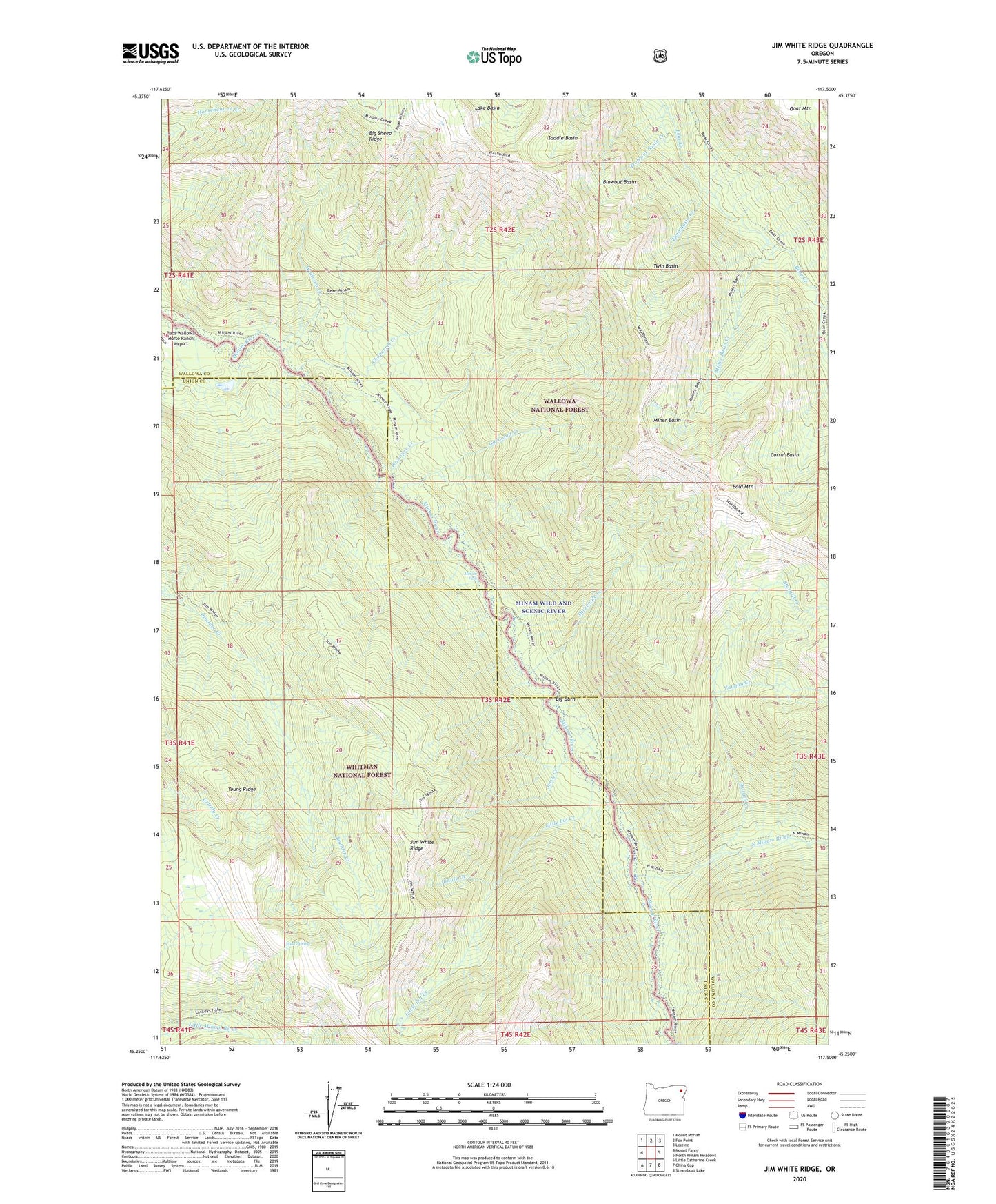
Jim White Ridge Oregon US Topo Map
Couldn't load pickup availability
Also explore the Jim White Ridge Forest Service Topo of this same quad for updated USFS data
2023 topographic map quadrangle Jim White Ridge in the state of Oregon. Scale: 1:24000. Based on the newly updated USGS 7.5' US Topo map series, this map is in the following counties: Wallowa, Union. The map contains contour data, water features, and other items you are used to seeing on USGS maps, but also has updated roads and other features. This is the next generation of topographic maps. Printed on high-quality waterproof paper with UV fade-resistant inks.
Quads adjacent to this one:
West: Mount Fanny
Northwest: Mount Moriah
North: Fox Point
Northeast: Lostine
East: North Minam Meadows
Southeast: Steamboat Lake
South: China Cap
Southwest: Little Catherine Creek
This map covers the same area as the classic USGS quad with code o45117c5.
Contains the following named places: Bald Mountain, Big Burn, Blowout Basin, Blowout Basin Creek, Chaparral Creek, Corral Basin, Garwood Creek, Granite Creek, Jerry Creek, Jim White Ridge, Jungle Creek, Little Pot Creek, Minam Falls, Minam Wild and Scenic River, Miner Basin, Miner Basin Creek, Mud Spring, North Minam River, Saddle Basin, Salt Trail, Sturgill Creek, Threemile Creek, Twin Basin, Twin Basin Creek, Vaughn Creek, Wallowa Creek, Washboard Trail, Whoopee Creek, Young Ridge