MyTopo
Crowley Oregon US Topo Map
Couldn't load pickup availability
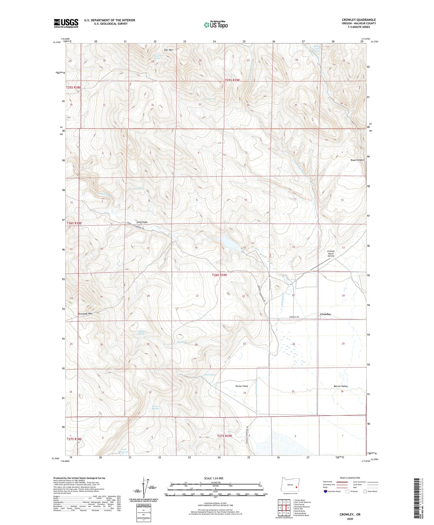
2023 topographic map quadrangle Crowley in the state of Oregon. Scale: 1:24000. Based on the newly updated USGS 7.5' US Topo map series, this map is in the following counties: Malheur. The map contains contour data, water features, and other items you are used to seeing on USGS maps, but also has updated roads and other features. This is the next generation of topographic maps. Printed on high-quality waterproof paper with UV fade-resistant inks.
Quads adjacent to this one:
West: Stockade Mountain
Northwest: Hickey Basin
North: Star Creek Reservoir
Northeast: Skull Spring
East: Burnt Flat
Southeast: Sacramento Butte
South: Mustang Butte
Southwest: Dowell Butte
This map covers the same area as the classic USGS quad with code o43117c8.
Contains the following named places: Crowley, Crowley Creek, Crowley Dam, Crowley Post Office, Crowley Ranch, Crowley Ranch Airstrip, Crowley Reservoir, Jurries Springs, Little Crowley Creek, Long Field, Long Spring, Marking Corral Springs, Porter Field, Porter Spring, Rapid Creek, South Star Spring, Twin Springs, Whiskey Springs