MyTopo
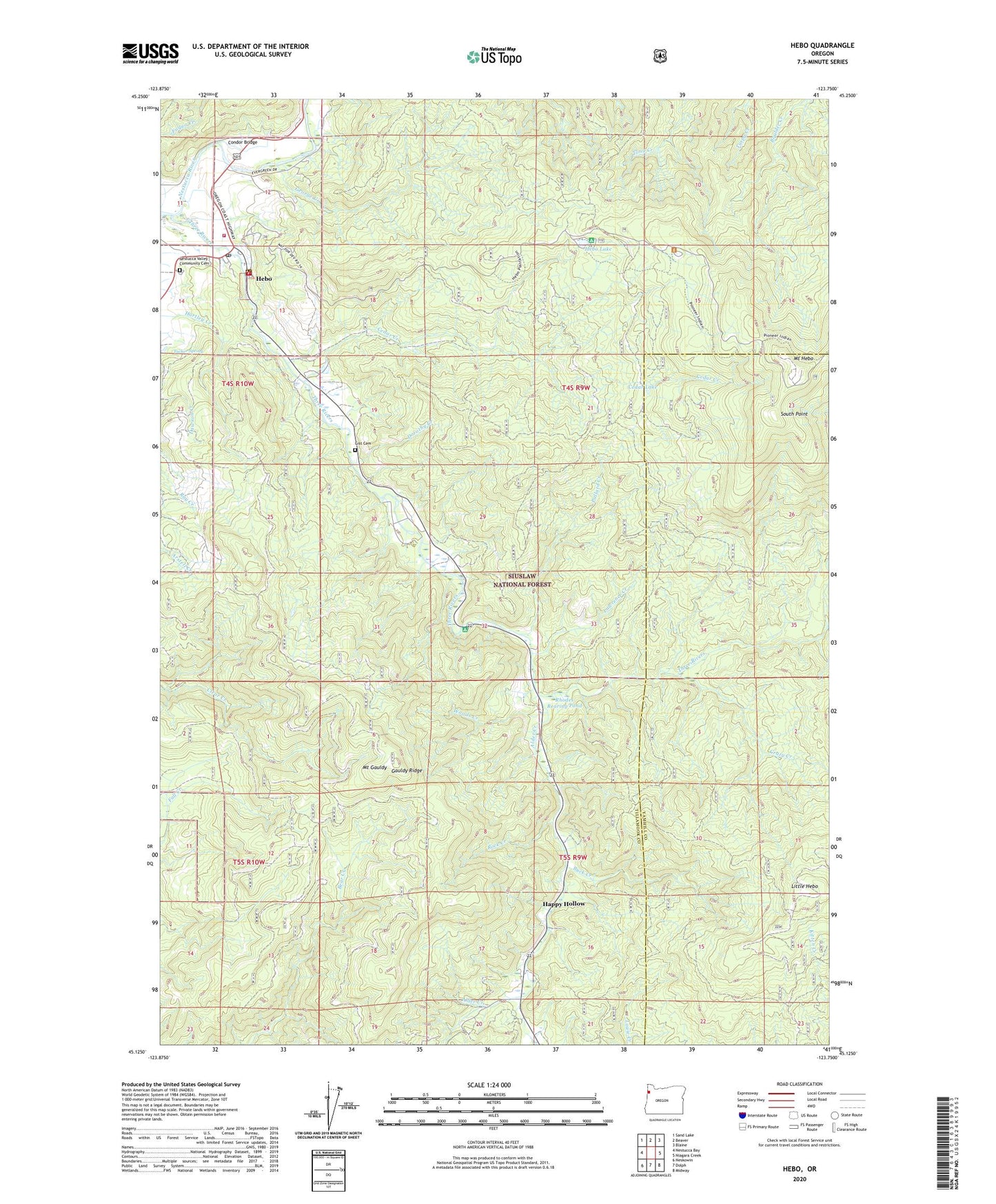
Hebo Oregon US Topo Map
Couldn't load pickup availability
Also explore the Hebo Forest Service Topo of this same quad for updated USFS data
2023 topographic map quadrangle Hebo in the state of Oregon. Scale: 1:24000. Based on the newly updated USGS 7.5' US Topo map series, this map is in the following counties: Tillamook, Yamhill. The map contains contour data, water features, and other items you are used to seeing on USGS maps, but also has updated roads and other features. This is the next generation of topographic maps. Printed on high-quality waterproof paper with UV fade-resistant inks.
Quads adjacent to this one:
West: Nestucca Bay
Northwest: Sand Lake
North: Beaver
Northeast: Blaine
East: Niagara Creek
Southeast: Midway
South: Dolph
Southwest: Neskowin
This map covers the same area as the classic USGS quad with code o45123b7.
Contains the following named places: Alder Creek, Buck Creek, Castle Rock, Castle Rock Recreation Site, Castlerock Lodge, Cedar Creek, Cedar Creek Administration Site Fish Hatchery, Cedar Lake, Condor Bridge, Crazy Creek, Dorothy Creek, Gauldy Ridge, George Creek, Gist Cemetery, Happy Hollow, Hebo, Hebo Census Designated Place, Hebo Joint Water and Sanitary Authority, Hebo Lake, Hebo Lake Recreation Site, Hebo Post Office, Hebo Ranger Station, Hebo Work Camp, Herbst Place, KTIL-FM, Lawrence Creek, Little Hebo, Mount Gauldy, Mount Hebo Air Force Station, Nestucca Rural Fire Protection District Station 81 Headquarters, Nestucca Valley Community Cemetery, Pollard Creek, Rhodes Rearing Pond, Rock Creek, South Point, Spring Creek, Three Rivers County Drift Boat Launch, Tucker Spring, United States Forest Service Hebo Ranger District, Woods Creek, ZIP Code: 97122