MyTopo
Beaver Oregon US Topo Map
Couldn't load pickup availability
Also explore the Beaver Forest Service Topo of this same quad for updated USFS data
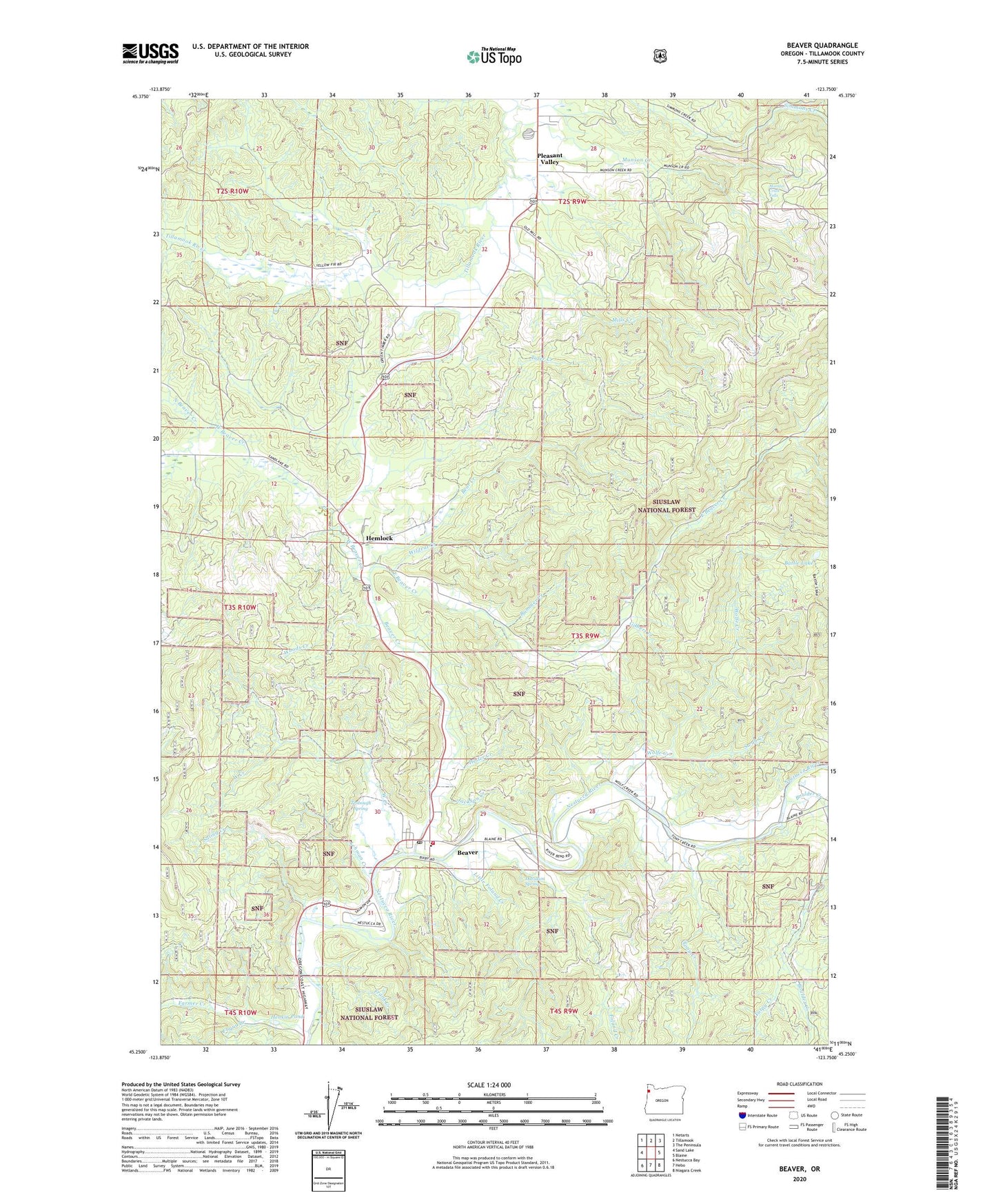
2023 topographic map quadrangle Beaver in the state of Oregon. Scale: 1:24000. Based on the newly updated USGS 7.5' US Topo map series, this map is in the following counties: Tillamook. The map contains contour data, water features, and other items you are used to seeing on USGS maps, but also has updated roads and other features. This is the next generation of topographic maps. Printed on high-quality waterproof paper with UV fade-resistant inks.
Quads adjacent to this one:
West: Sand Lake
Northwest: Netarts
North: Tillamook
Northeast: The Peninsula
East: Blaine
Southeast: Niagara Creek
South: Hebo
Southwest: Nestucca Bay
This map covers the same area as the classic USGS quad with code o45123c7.
Contains the following named places: Battle Lake, Bear Creek, Beaver, Beaver Census Designated Place, Beaver Creek, Beaver Creek Forest Camp, Beaver Division, Beaver Post Office, Bixby County Drift Boat Launch, Boulder Creek, Bummer Creek, Davidson Spring, East Beaver Creek, Farmer Creek, Farmer Creek Boat Ramp, Farmer Creek Rest Area, First Bridge Ramp, Foland Creek, Fourth Bridge Ramp, Frank Creek, Fuqua Creek, Gilbert Creek, Hemlock, Hemlock Post Office, Henkin Pond, Hester Creek, Jackson Creek, Lehman Creek, Little Foland Creek, Mills Creek, Munson Creek, Munson Creek Falls, Munson Creek Falls State Natural Area, Nestucca Rural Fire Protection District Station 83 Beaver, Nestucca Valley Middle School, North Beaver Creek, Pleasant Valley, River Front Dairy, Saling Creek, Spruce Post Office, Swab Creek, Ti - Sue Dairy, Tiger Creek, Tony Creek, Trobough Spring, Turpy Creek, Walter Creek, West Beaver Creek, West Creek, Wildcat Creek, Wolfe Creek, Woods Creek, ZIP Code: 97112