MyTopo
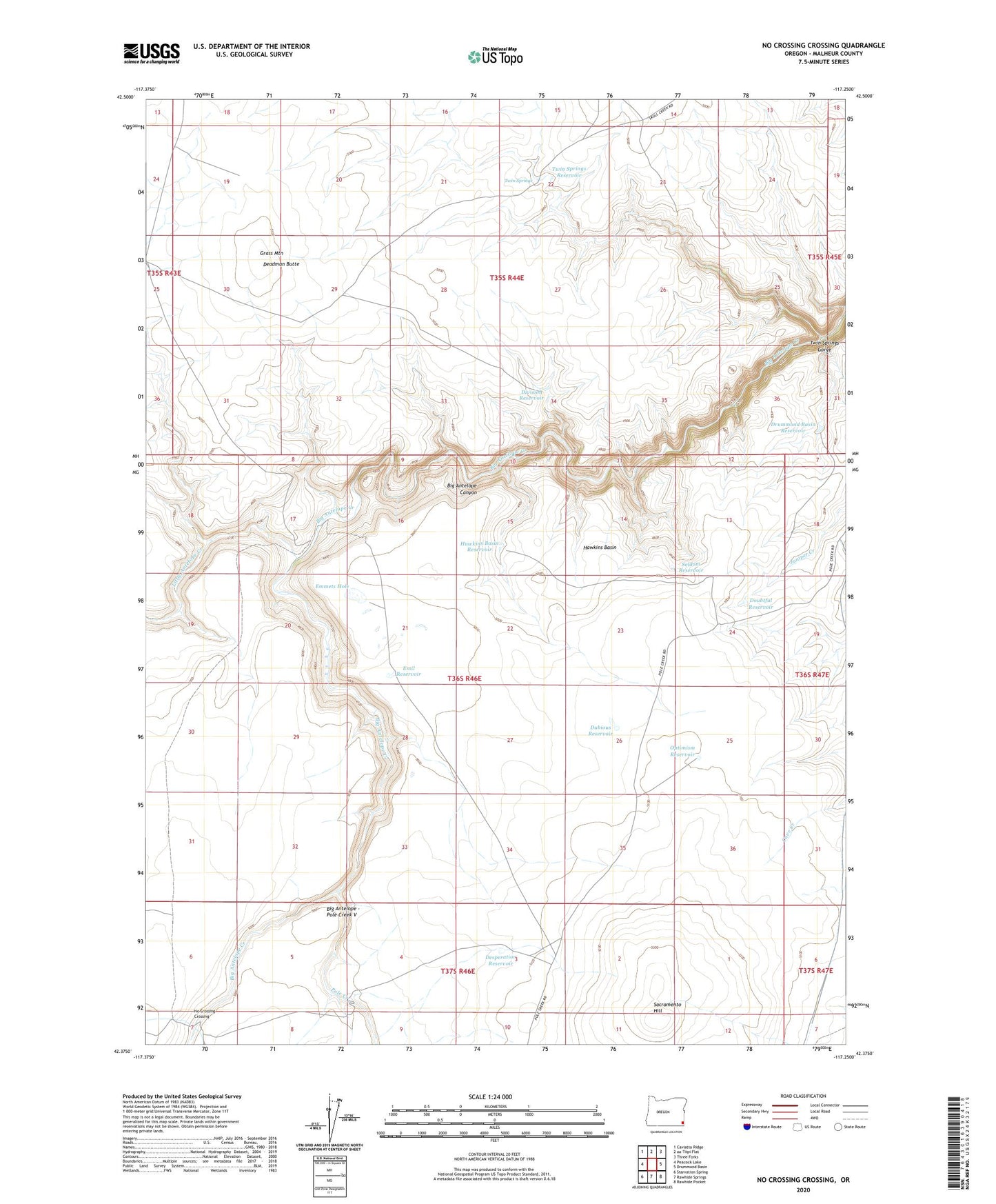
No Crossing Crossing Oregon US Topo Map
Couldn't load pickup availability
2023 topographic map quadrangle No Crossing Crossing in the state of Oregon. Scale: 1:24000. Based on the newly updated USGS 7.5' US Topo map series, this map is in the following counties: Malheur. The map contains contour data, water features, and other items you are used to seeing on USGS maps, but also has updated roads and other features. This is the next generation of topographic maps. Printed on high-quality waterproof paper with UV fade-resistant inks.
Quads adjacent to this one:
West: Peacock Lake
Northwest: Caviatta Ridge
Northeast: Three Forks
East: Drummond Basin
Southeast: Rawhide Pocket
South: Rawhide Springs
Southwest: Starvation Spring
This map covers the same area as the classic USGS quad with code o42117d3.
Contains the following named places: Antelope Corral, Big Antelope - Pole Creek V, Collumbaugh Corral, Deadman Butte, Desperation Reservoir, Division Reservoir, Doubtful Reservoir, Drummond Basin Reservoir, Dubious Reservoir, Emil Reservoir, Emmets Hole, Five Points, Grass Mountain, Hawkins Basin, Hawkins Basin Reservoir, Little Antelope Creek, No Crossing Crossing, Optimism Reservoir, Pole Creek, Sacramento Hill, Seldom Reservoir, Twin Springs, Twin Springs Gorge, Twin Springs Reservoir