MyTopo
Drummond Basin Oregon US Topo Map
Couldn't load pickup availability
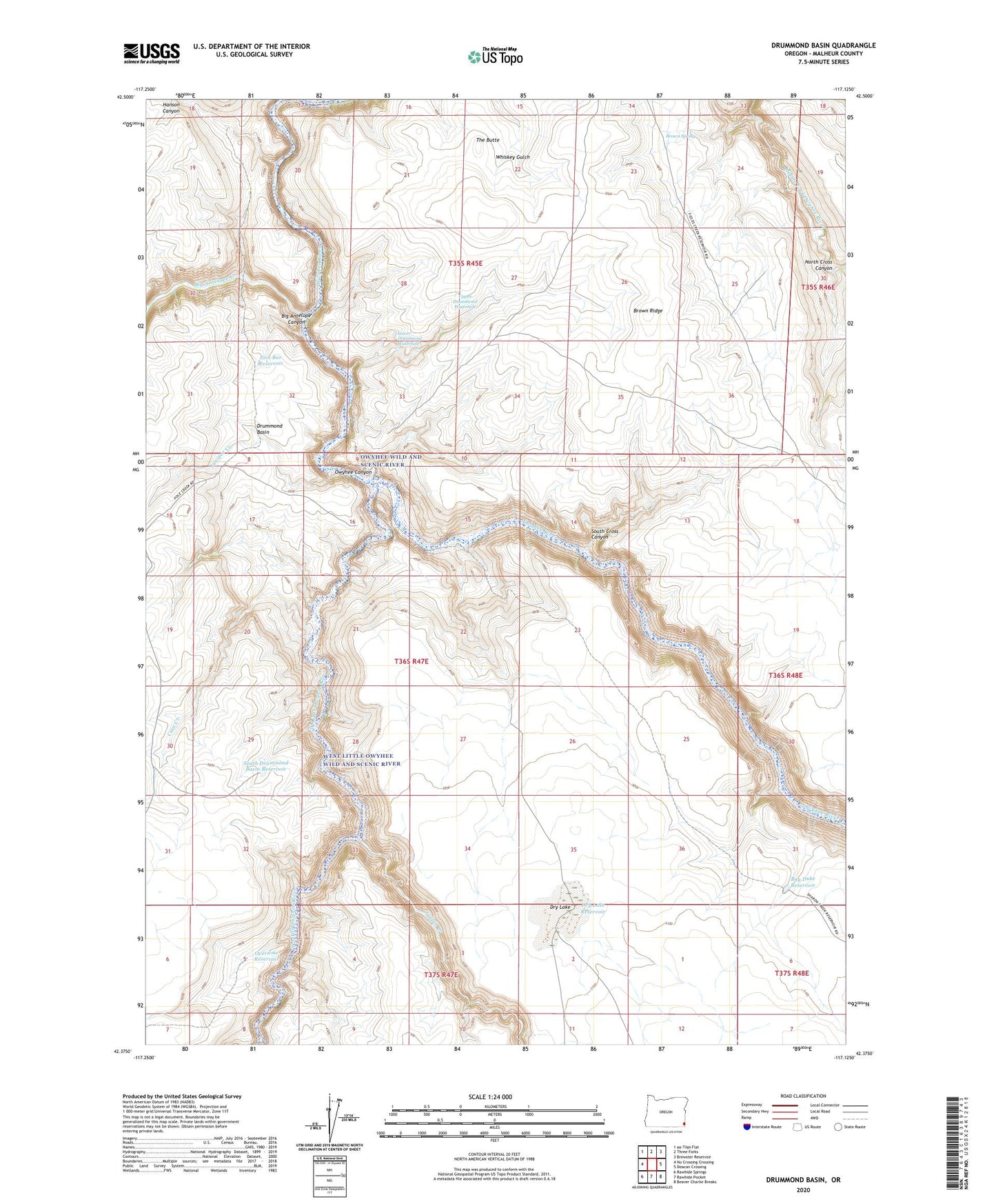
2024 topographic map quadrangle Drummond Basin in the state of Oregon. Scale: 1:24000. Based on the newly updated USGS 7.5' US Topo map series, this map is in the following counties: Malheur. The map contains contour data, water features, and other items you are used to seeing on USGS maps, but also has updated roads and other features. This is the next generation of topographic maps. Printed on high-quality waterproof paper with UV fade-resistant inks.
Quads adjacent to this one:
West: No Crossing Crossing
North: Three Forks
Northeast: Brewster Reservoir
East: Deacon Crossing
Southeast: Beaver Charlie Breaks
South: Rawhide Pocket
Southwest: Rawhide Springs
This map covers the same area as the classic USGS quad with code o42117d2.
Contains the following named places: Bay Duke Reservoir, Big Antelope Canyon, Big Antelope Creek, Brown Ridge, Brown Spring, Cave Creek, Drummond Basin, Dry Lake, Dry Lake Reservoir, Five Bar, Five Bar Reservoir, Half Way Tree, Hanson Canyon, Juniper Creek, Lower Crossing Big Antelope Creek, Lower Drummond Waterhole, North Cross Canyon, Overtime Reservoir, South Cross Canyon, South Drummond Basin Reservoir, The Butte, Toppin Creek, Toppin Creek V, Upper Drummond Waterhole, West Little Owyhee River