MyTopo
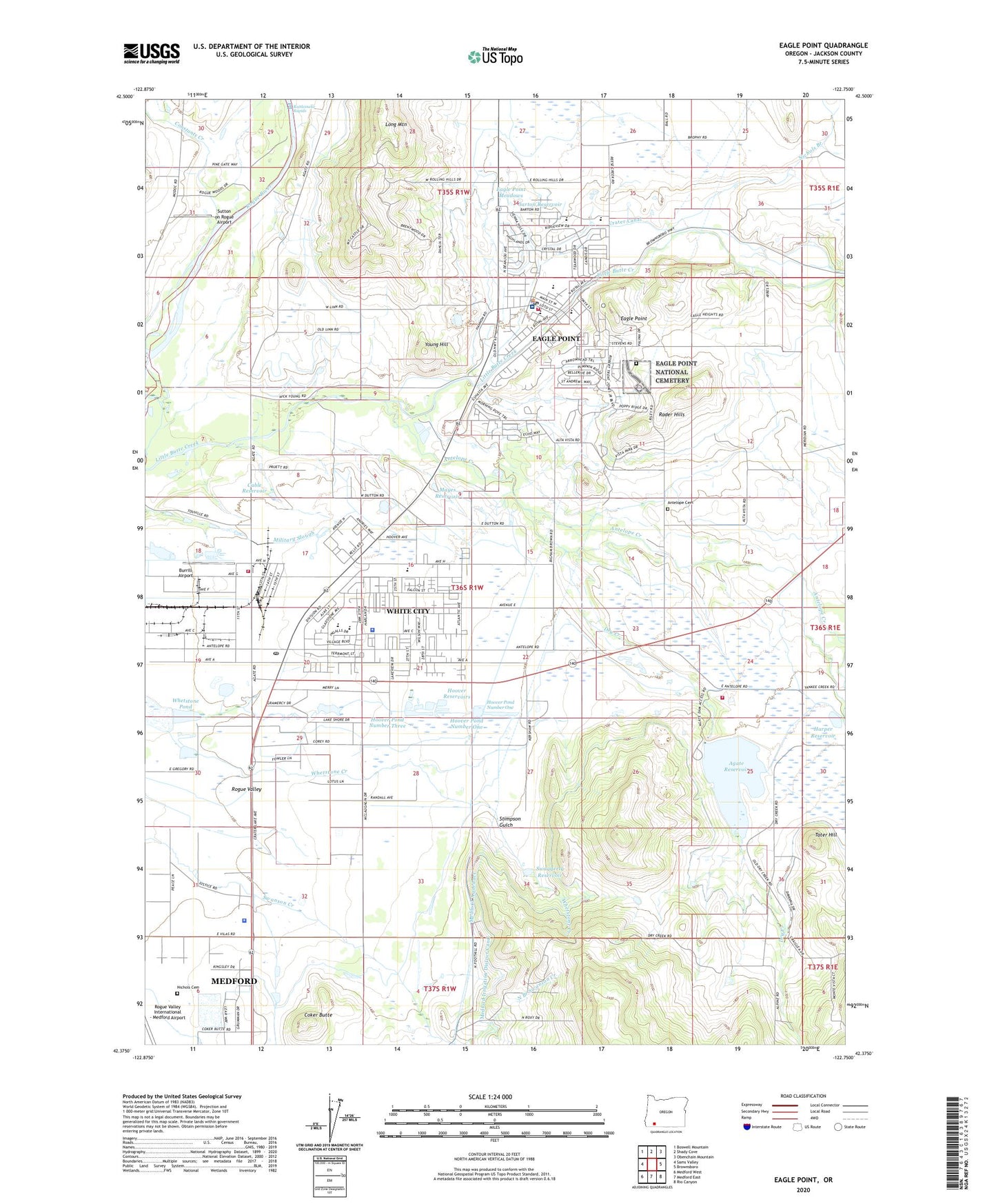
Eagle Point Oregon US Topo Map
Couldn't load pickup availability
2024 topographic map quadrangle Eagle Point in the state of Oregon. Scale: 1:24000. Based on the newly updated USGS 7.5' US Topo map series, this map is in the following counties: Jackson. The map contains contour data, water features, and other items you are used to seeing on USGS maps, but also has updated roads and other features. This is the next generation of topographic maps. Printed on high-quality waterproof paper with UV fade-resistant inks.
Quads adjacent to this one:
West: Sams Valley
Northwest: Boswell Mountain
North: Shady Cove
Northeast: Obenchain Mountain
East: Brownsboro
Southeast: Rio Canyon
South: Medford East
Southwest: Medford West
This map covers the same area as the classic USGS quad with code o42122d7.
Contains the following named places: Agate Dam, Agate Lake County Park, Agate Lake Jackson County Boat Ramp, Agate Reservoir, Agate Station, Antelope Cemetery, Antelope Creek, Antelope School, Ash Creek, Barton Reservoir, Biomass One Facility, Burrill Airport, Cable Reservoir, Camp White, Camp White Historical Association and Military Museum, Cascade Shopping Center Park and Ride, City of Eagle Point, Coker Butte, Constants Creek, Crater Canal, Creede Post Office, Davis, Dry Creek, Dry Creek Landfill, Eagle Point, Eagle Point City Hall, Eagle Point Division, Eagle Point High School, Eagle Point Historical Society Museum, Eagle Point Library, Eagle Point Meadows, Eagle Point Middle School, Eagle Point Municipal Court, Eagle Point National Cemetery, Eagle Point Police Department, Eagle Point Post Office, Eagle Point Public Works Department, Eagle Rock Elementary School, Glen D Hale Elementary School, Harper Reservoir, Hoover Dam Number 1, Hoover Dam Number 2, Hoover Dam Number 3, Hoover Pond Number One, Hoover Pond Number Three, Hoover Pond Number Two, Hoover Ponds County Park, Hoover Reservoirs, Jackson County Fire District 3 Agate Lake Station, Jackson County Fire District 3 Eagle Point Station, Jackson County Fire District 3 White City Station Headquarters, Jackson County Sheriff's Office Substation, Jackson County Sports Park, Ken Denman State Game Management Reserve, KEPO-FM, KYJC-AM, Little Butte Creek Watershed Council, Little Butte Elementary School, Long Mountain, Mayes Reservoir, McLoughlin Airfield, Medco Number 3 Dam, Medco Number 3 Pond, Mountain View, Mountain View Elementary, Nichols Branch, Nichols Cemetery, Penniger, Rader Hills, Rattlesnake Rapids, Saint John Lutheran School, Smiths Post Office, Southern Oregon Speedway Dragway and Outdoor Kart Track, Stimpson Gulch, Sutton on Rogue Airport, Swaggerty Reservoir, Table Rock Elementary, Table Rock Station, Tater Hill, Veterans Affairs Domiciliary, Veterans Affairs Domiciliary Park and Ride, Wellen, Wellen Post Office, Whetstone Pond, White City, White City Branch Library, White City Census Designated Place, White City Post Office, Young Hill


