MyTopo
Pickett Butte Oregon US Topo Map
Couldn't load pickup availability
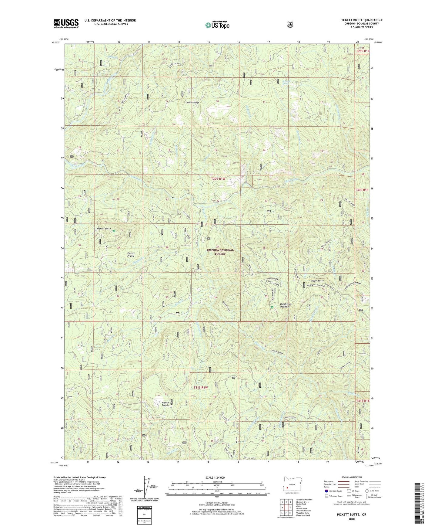
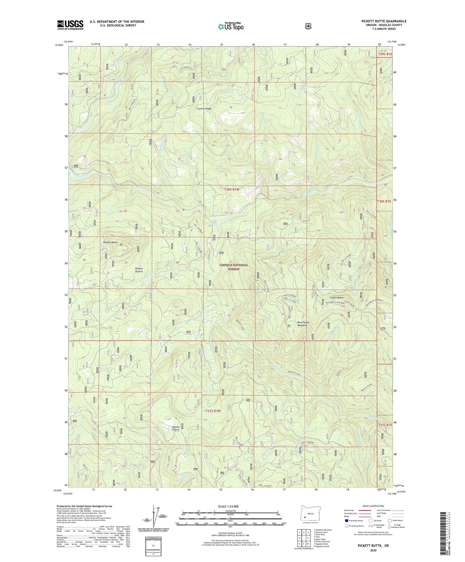
2020 topographic map quadrangle Pickett Butte in the state of Oregon. Scale: 1:24000. Based on the newly updated USGS 7.5' US Topo map series, this map is in the following counties: Douglas. The map contains contour data, water features, and other items you are used to seeing on USGS maps, but also has updated roads and other features. This is the next generation of topographic maps. Printed on high-quality waterproof paper with UV fade-resistant inks.
Quads adjacent to this one:
West: Tiller
Northwest: Deadman Mountain
North: Dumont Creek
Northeast: Acker Rock
East: Butler Butte
Southeast: Sugarpine Creek
South: Ragsdale Butte
Southwest: Richter Mountain
Contains the following named places: Allan Creek, Beaver Creek, Beaver Lake, Bullock Creek, Bunchgrass Meadows, Bunchgrass Meadows Shelter, Burnt Creek, Chapman Creek, Coffin Butte, Coffin Butte Lookout, Coffin Creek, Collins Creek, Collins Lookout, Collins Ridge, Devils Knob Creek, Freezeout Trail, Hamlin Prairie, Mule Creek, Nichols Creek, Nichols Ranch, Pickett Butte, Pickett Butte Lookout Tower, Pickett Prairie, Pipestone Creek, Pode Creek, Red Lick Spring, Stampede Creek, Summit Guard Station, Surveyor Creek, Switchback Creek, Three Cabin Creek, Winters Creek, ZIP Code: 97484