MyTopo
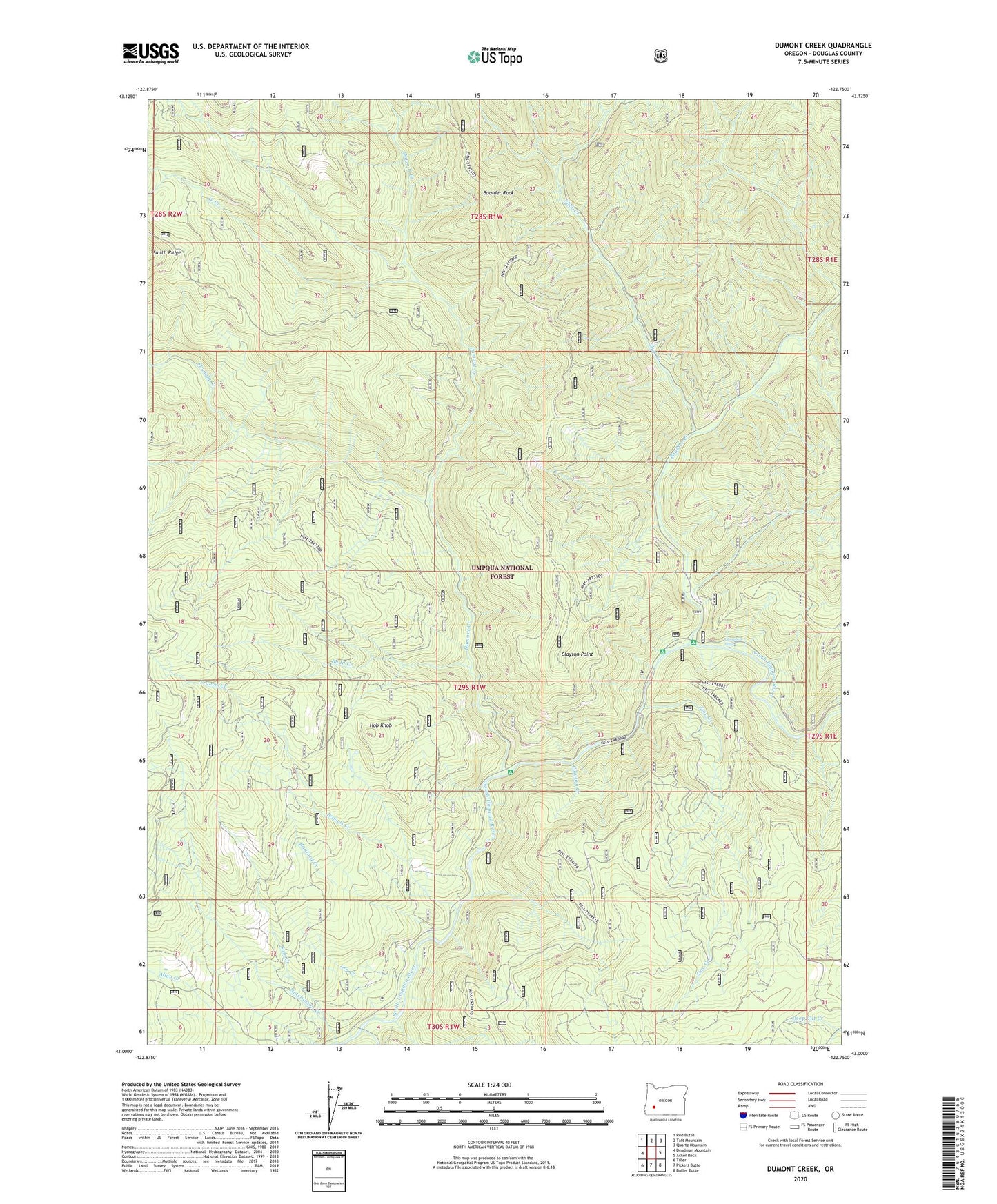
Dumont Creek Oregon US Topo Map
Couldn't load pickup availability
Also explore the Dumont Creek Forest Service Topo of this same quad for updated USFS data
2023 topographic map quadrangle Dumont Creek in the state of Oregon. Scale: 1:24000. Based on the newly updated USGS 7.5' US Topo map series, this map is in the following counties: Douglas. The map contains contour data, water features, and other items you are used to seeing on USGS maps, but also has updated roads and other features. This is the next generation of topographic maps. Printed on high-quality waterproof paper with UV fade-resistant inks.
Quads adjacent to this one:
West: Deadman Mountain
Northwest: Red Butte
North: Taft Mountain
Northeast: Quartz Mountain
East: Acker Rock
Southeast: Butler Butte
South: Pickett Butte
Southwest: Tiller
This map covers the same area as the classic USGS quad with code o43122a7.
Contains the following named places: Boulder Annex Recreation Site, Boulder Creek, Boulder Creek Recreation Site, Boulder Creek Umpqua National Forest Boat Launch, Boulder Rock, Budd Creek, Campbell Falls, Clayton Creek, Clayton Point, Dry Creek, Dumont Creek, Dumont Creek Recreation Site, Francis Creek, Hob Knob, Hutchinson Creek, Radford Creek, Sam Creek, Slick Creek, Straight Creek, Straight Creek Trail, West Creek, Zinc Creek