MyTopo
Acker Rock Oregon US Topo Map
Couldn't load pickup availability
Also explore the Acker Rock Forest Service Topo of this same quad for updated USFS data
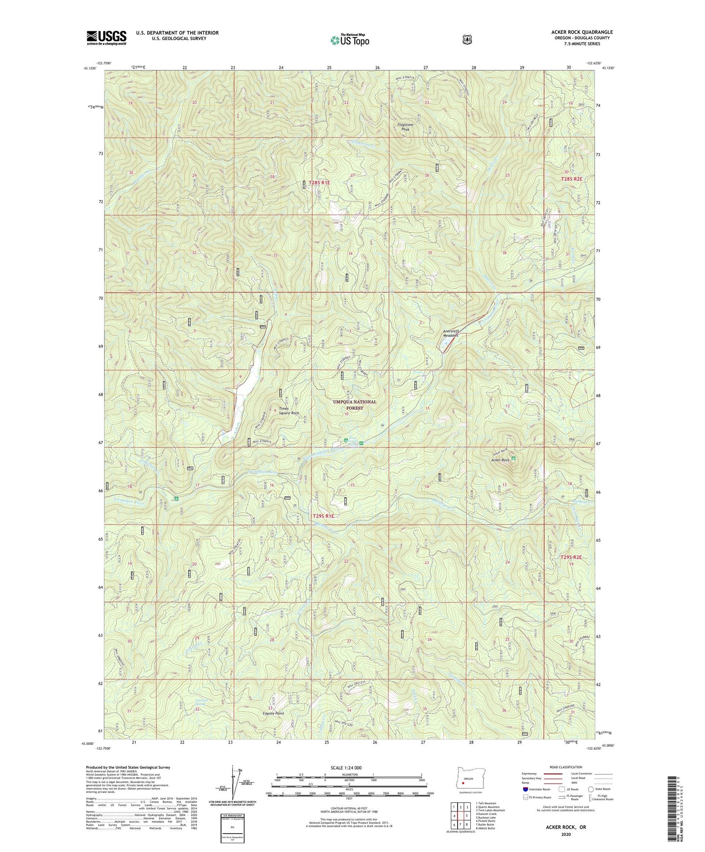
2023 topographic map quadrangle Acker Rock in the state of Oregon. Scale: 1:24000. Based on the newly updated USGS 7.5' US Topo map series, this map is in the following counties: Douglas. The map contains contour data, water features, and other items you are used to seeing on USGS maps, but also has updated roads and other features. This is the next generation of topographic maps. Printed on high-quality waterproof paper with UV fade-resistant inks.
Quads adjacent to this one:
West: Dumont Creek
Northwest: Taft Mountain
North: Quartz Mountain
Northeast: Twin Lakes Mountain
East: Buckeye Lake
Southeast: Abbott Butte
South: Butler Butte
Southwest: Pickett Butte
This map covers the same area as the classic USGS quad with code o43122a6.
Contains the following named places: Acker Rock, Andraieff Meadows, Ash Creek, Buckeye Creek, Camp Coffee Pot, Camp Vena, Coffeepot Creek, Coyote Creek, Coyote Point, Erlebach Ranch, Flagstone Creek, Flagstone Peak, Flood Creek, Junction Spring, Last Camp, Last Creek, Quartz Creek, Skookum Chuck Camp, Skookum Creek Camp, South Umpqua Experimental Forest, South Umpqua Falls, South Umpqua Guard Station, Times Square Rock, Twin Buck Creek, Twinbuck Camp