MyTopo
Tubb Spring Oregon US Topo Map
Couldn't load pickup availability
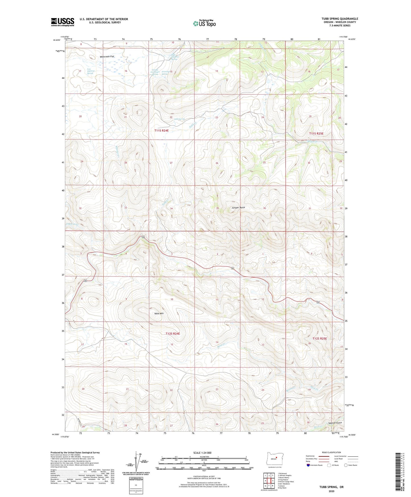
2023 topographic map quadrangle Tubb Spring in the state of Oregon. Scale: 1:24000. Based on the newly updated USGS 7.5' US Topo map series, this map is in the following counties: Wheeler. The map contains contour data, water features, and other items you are used to seeing on USGS maps, but also has updated roads and other features. This is the next generation of topographic maps. Printed on high-quality waterproof paper with UV fade-resistant inks.
Quads adjacent to this one:
West: Frog Hollow
Northwest: Richmond
North: Johnson Heights
Northeast: Mount Misery
East: Picture Gorge West
Southeast: Day Basin
South: Antone
Southwest: Derr Meadows
This map covers the same area as the classic USGS quad with code o44119e7.
Contains the following named places: Fopiano Creek, George Iremonger Spring, High Gilchrist Spring, Iremonger Spring, Juniper Butte, Low Gilchrist Spring, Spanish Gulch, Spring Creek, Table Mountain, Tubb Creek, Tubb Spring, Wheeler Creek, Willow Creek