MyTopo
Putnam Valley Oregon US Topo Map
Couldn't load pickup availability
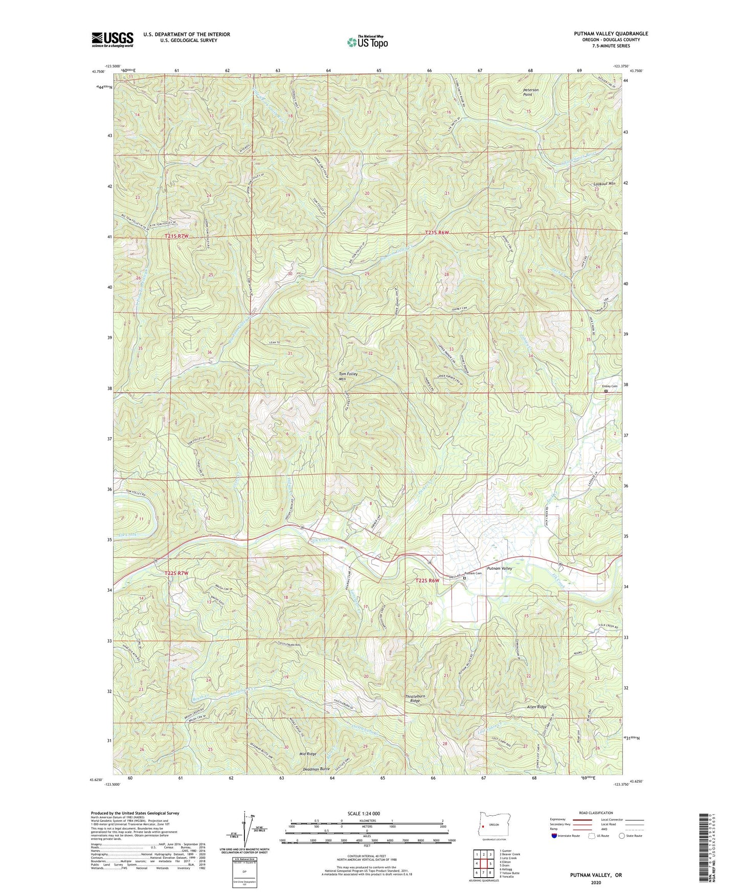
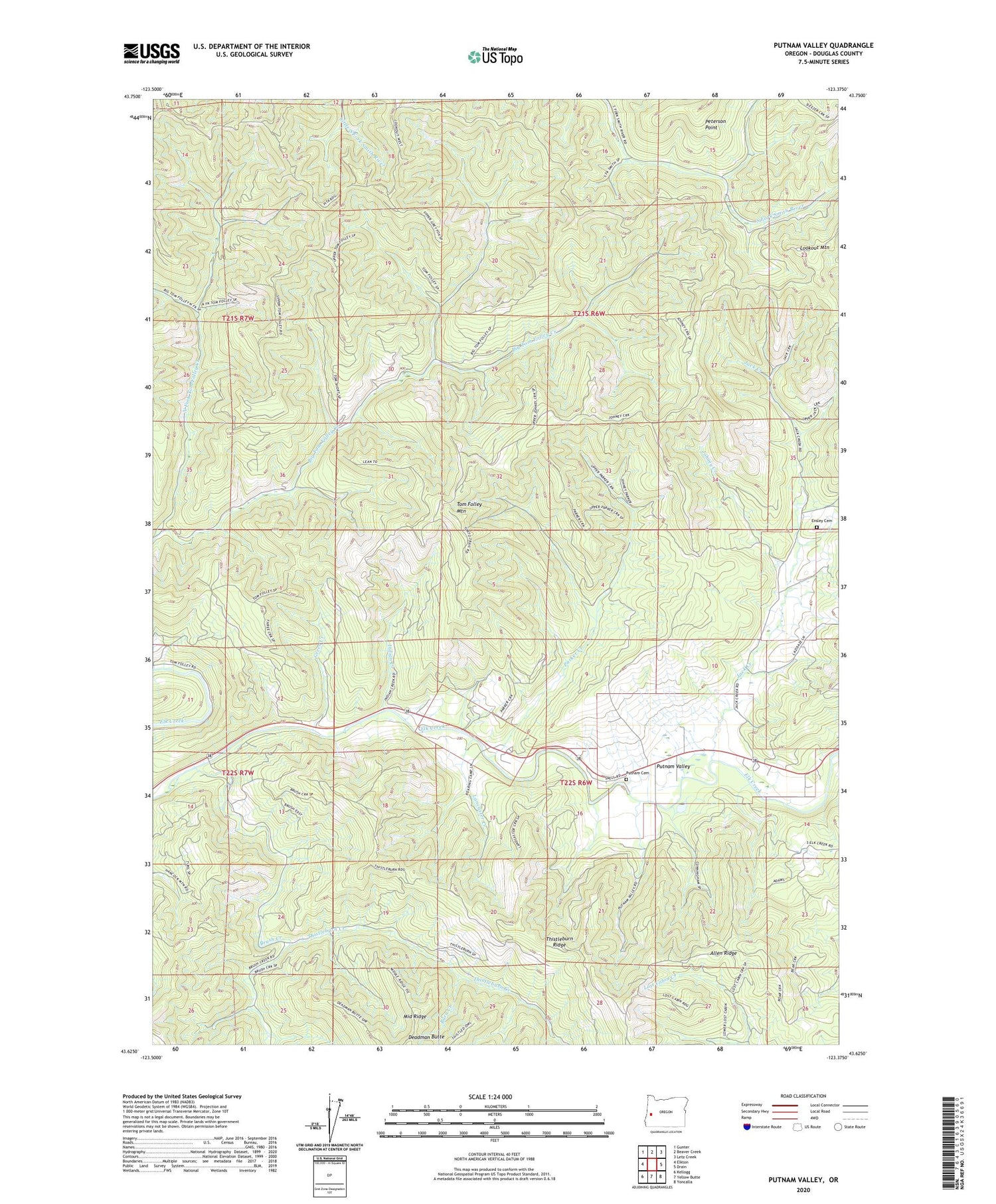
2020 topographic map quadrangle Putnam Valley in the state of Oregon. Scale: 1:24000. Based on the newly updated USGS 7.5' US Topo map series, this map is in the following counties: Douglas. The map contains contour data, water features, and other items you are used to seeing on USGS maps, but also has updated roads and other features. This is the next generation of topographic maps. Printed on high-quality waterproof paper with UV fade-resistant inks.
Quads adjacent to this one:
West: Elkton
Northwest: Gunter
North: Beaver Creek
Northeast: Letz Creek
East: Drain
Southeast: Yoncalla
South: Yellow Butte
Southwest: Kellogg
Contains the following named places: Allen Ridge, Brush Creek, Burn Creek, Deadman Butte, Ensley Cemetery, Flagg Reservoir, Green Creek, Indian Creek, Jack Creek, Johney Creek, Lancaster Creek, Lookout Mountain, North Fork Tom Folley Creek, Parker Creek, Peterson Point, Putnam Cemetery, Putnam Valley, Sunnydale, Sunnydale School, Thistleburn Creek, Thistleburn Ridge, Tom Folley Mountain