MyTopo
Reynolds Ridge Oregon US Topo Map
Couldn't load pickup availability
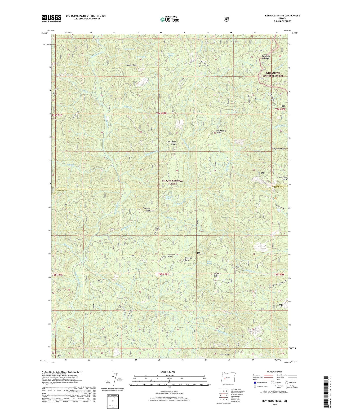
2020 topographic map quadrangle Reynolds Ridge in the state of Oregon. Scale: 1:24000. Based on the newly updated USGS 7.5' US Topo map series, this map is in the following counties: Lane, Douglas. The map contains contour data, water features, and other items you are used to seeing on USGS maps, but also has updated roads and other features. This is the next generation of topographic maps. Printed on high-quality waterproof paper with UV fade-resistant inks.
Quads adjacent to this one:
West: Chilcoot Mountain
Northwest: Fairview Peak
North: Bearbones Mountain
Northeast: Warner Mountain
East: Staley Ridge
Southeast: Toketee Falls
South: Illahee Rock
Southwest: Steamboat
Contains the following named places: Big Bend Creek, Bulldog Creek, Bullpup Lake, Buster Butte, Buster Creek, Buster Spring, Cedar Creek, Cedar Spring, City Creek, City Creek Shelter, Firemans Leap, Granddad Butte, Grassy Ranch Camp, Grassy Ranch Trail, Homestead Camp, Homestead Creek, Homestead Ridge, Illahee Spring, Johnson Camp, Johnson Creek, Little Bend Creek, Little Rock Creek, Longs Creek, Lost Camp Prairie, Midnight Spring, North Fork Cedar Creek, Pyramid Rock, Reynolds Butte, Reynolds Creek, Reynolds Ridge, Reynolds Ridge Lookout, Reynolds Shelter, Slim Chance Campground, South Fork Cedar Creek, Threemile Spring, Washboard Ridge, Yellowjacket Trail