MyTopo
Bearbones Mountain Oregon US Topo Map
Couldn't load pickup availability
Also explore the Bearbones Mountain Forest Service Topo of this same quad for updated USFS data
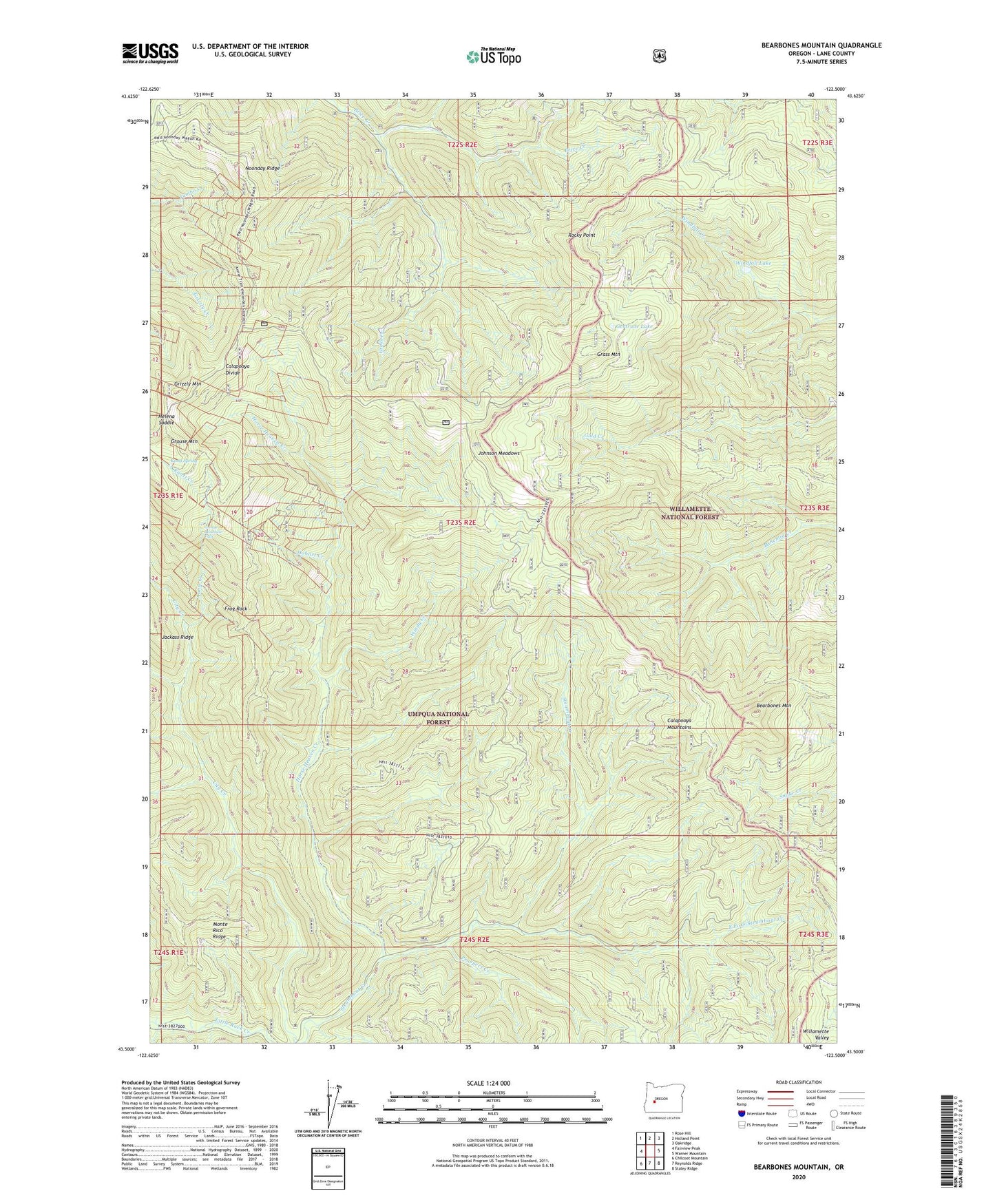
2024 topographic map quadrangle Bearbones Mountain in the state of Oregon. Scale: 1:24000. Based on the newly updated USGS 7.5' US Topo map series, this map is in the following counties: Lane. The map contains contour data, water features, and other items you are used to seeing on USGS maps, but also has updated roads and other features. This is the next generation of topographic maps. Printed on high-quality waterproof paper with UV fade-resistant inks.
Quads adjacent to this one:
West: Fairview Peak
Northwest: Rose Hill
North: Holland Point
Northeast: Oakridge
East: Warner Mountain
Southeast: Staley Ridge
South: Reynolds Ridge
Southwest: Chilcoot Mountain
This map covers the same area as the classic USGS quad with code o43122e5.
Contains the following named places: Annie Creek, Bearbones Mountain, Calapooya Way, Champion Post Office, Colorado Mine, East Fork Steamboat Creek, Frog Rock, Gertrude Lake, Gertrude Shelter, Grass Creek, Grass Mountain, Grizzly Mountain, Grouse Mountain, Grouse Mountain Falls, Helena Mine, Helena Saddle, Hobart Creek, Horse Heaven Creek, Johnson Meadows, Johnson Meadows Trail, Knott Creek, Knott Spring, Mayflower Mine, Mayflower Trail, Noonday Mine, Noonday Ridge, Prospect Creek, Rocky Point, Saint Peter Creek, Skeeter Camp, Skeeter Camp Trail, Steamboat Trail, Windfall Lake, Windy Creek