MyTopo
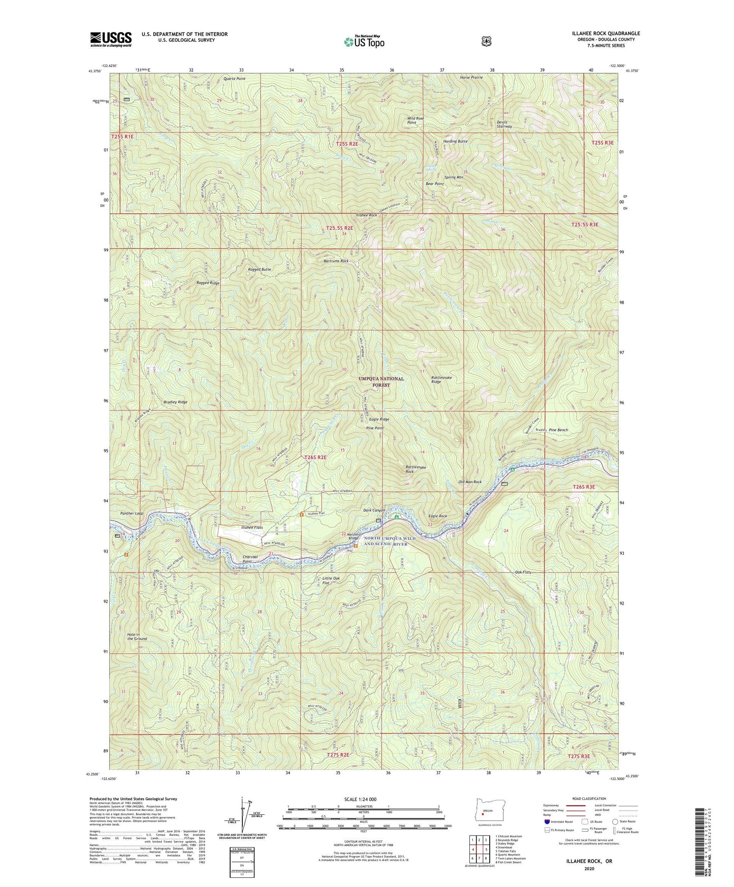
Illahee Rock Oregon US Topo Map
Couldn't load pickup availability
Also explore the Illahee Rock Forest Service Topo of this same quad for updated USFS data
2023 topographic map quadrangle Illahee Rock in the state of Oregon. Scale: 1:24000. Based on the newly updated USGS 7.5' US Topo map series, this map is in the following counties: Douglas. The map contains contour data, water features, and other items you are used to seeing on USGS maps, but also has updated roads and other features. This is the next generation of topographic maps. Printed on high-quality waterproof paper with UV fade-resistant inks.
Quads adjacent to this one:
West: Steamboat
Northwest: Chilcoot Mountain
North: Reynolds Ridge
Northeast: Staley Ridge
East: Toketee Falls
Southeast: Fish Creek Desert
South: Twin Lakes Mountain
Southwest: Quartz Mountain
This map covers the same area as the classic USGS quad with code o43122c5.
Contains the following named places: Bartrums Rock, Bear Point, Boulder Creek, Boulder Flat Recreation Site, Bradley Ridge, Calf Creek, Charcoal Point, Collins Camp, Copeland Creek, Dark Canyon, Deception Creek, Deception Way, Devils Stairway, Dry Creek, Dry Creek Cabin, Dry Gulch Creek, Eagle Creek, Eagle Ridge, Eagle Rock, Eagle Rock Recreation Site, Happy Creek, Harding Butte, Hole in the Ground, Horse Prairie, Illahee Flats, Illahee Guard Station, Illahee Rock, Illahee Spring, Little Oak Flat, Marsters Bridge, North Umpqua Division, Oak Flat Lookout, Oak Flats, Old Man Rock, Onion Creek, Panther Leap, Pine Bench, Pine Point, Quartz Point, Ragged Butte, Ragged Ridge, Rattlesnake Creek, Rattlesnake Ridge, Rattlesnake Rock, Snuff Shelter, Soda Springs Power Plant, Spring Mountain, Spring Mountain Way, Weeping Rock Campground, Weeping Rock Campground Boat Launch, Wild Rose Camp, Wild Rose Point, Wilson Creek