MyTopo
Chilcoot Mountain Oregon US Topo Map
Couldn't load pickup availability
Also explore the Chilcoot Mountain Forest Service Topo of this same quad for updated USFS data
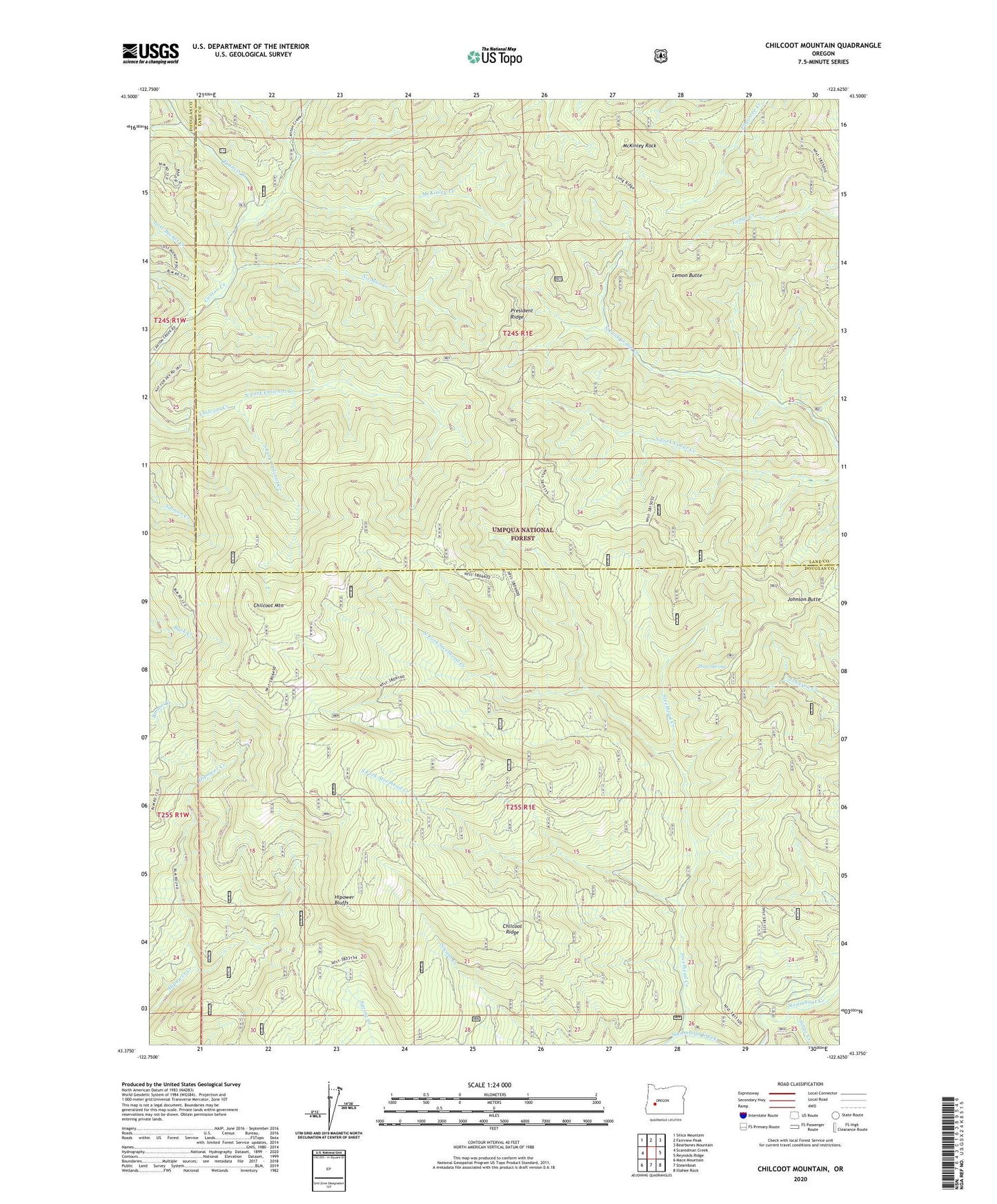
2023 topographic map quadrangle Chilcoot Mountain in the state of Oregon. Scale: 1:24000. Based on the newly updated USGS 7.5' US Topo map series, this map is in the following counties: Douglas, Lane. The map contains contour data, water features, and other items you are used to seeing on USGS maps, but also has updated roads and other features. This is the next generation of topographic maps. Printed on high-quality waterproof paper with UV fade-resistant inks.
Quads adjacent to this one:
West: Scaredman Creek
Northwest: Silica Mountain
North: Fairview Peak
Northeast: Bearbones Mountain
East: Reynolds Ridge
Southeast: Illahee Rock
South: Steamboat
Southwest: Mace Mountain
This map covers the same area as the classic USGS quad with code o43122d6.
Contains the following named places: Bona Fida Shelter, Champion, Chilcoot Junction Shelter, Chilcoot Mountain, Chilcoot Ridge, Chilcoot Trail, Francis Creek, Hipower Bluffs, Johnson Butte, Johnson Trail, Lemon Butte, Lost Bucket Creek, McKinley Creek, McKinley Rock, No Man Creek, North Fork Chilcoot Creek, North Fork Steelhead Creek, President Ridge, Singe Creek, South Fork Chilcoot Creek, South Fork Steelhead Creek, Three Springs