MyTopo
South Mountain Oregon US Topo Map
Couldn't load pickup availability
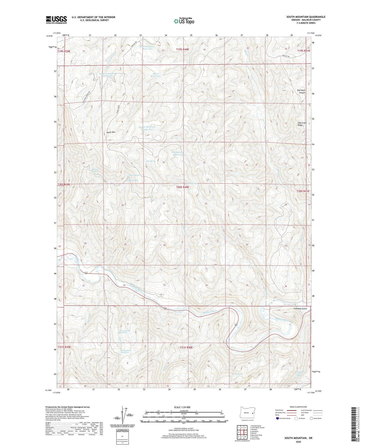
2023 topographic map quadrangle South Mountain in the state of Oregon. Scale: 1:24000. Based on the newly updated USGS 7.5' US Topo map series, this map is in the following counties: Malheur. The map contains contour data, water features, and other items you are used to seeing on USGS maps, but also has updated roads and other features. This is the next generation of topographic maps. Printed on high-quality waterproof paper with UV fade-resistant inks.
Quads adjacent to this one:
West: Jonesboro
Northwest: Westfall Butte
North: Little Black Canyon
Northeast: Westfall
East: Namorf
Southeast: Avery Creek
South: Tims Peak
Southwest: Monument Peak
This map covers the same area as the classic USGS quad with code o43117g7.
Contains the following named places: Alfred Reservoir, Bohna, Boney Spring Number 1, Boney Spring Number 2, China Creek, Coyne Spring, Coyote Spring, Gold Creek, Hinkle Ranch, Hog Creek, Hog Creek Reservoir Number Two, Mason Post Office, Miller Creek, P Coyne Ranch, Perry Ranch, Perry Spring, Rim Spring, Rimrock Spring, Simmons Gulch, Simmons Gulch Spring, South Cottonwood Reservoir, South Mountain, South Mountain Reservoir, Sperry, Sperry Creek, Spring Creek, Tub Springs Reservoir, Tunnel Spur