MyTopo
Tims Peak Oregon US Topo Map
Couldn't load pickup availability
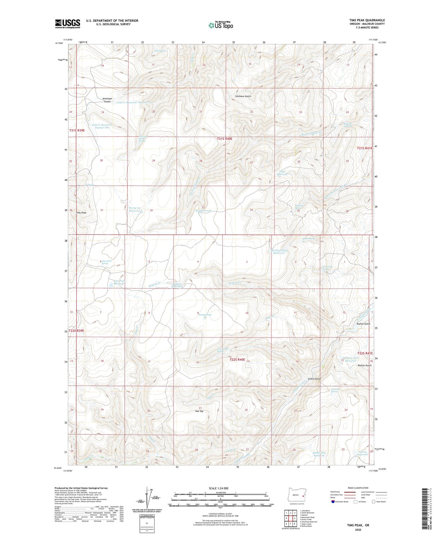
2024 topographic map quadrangle Tims Peak in the state of Oregon. Scale: 1:24000. Based on the newly updated USGS 7.5' US Topo map series, this map is in the following counties: Malheur. The map contains contour data, water features, and other items you are used to seeing on USGS maps, but also has updated roads and other features. This is the next generation of topographic maps. Printed on high-quality waterproof paper with UV fade-resistant inks.
Quads adjacent to this one:
West: Monument Peak
Northwest: Jonesboro
North: South Mountain
Northeast: Namorf
East: Avery Creek
Southeast: Rufino Butte
South: Alder Creek
Southwest: Shumway Reservoir
This map covers the same area as the classic USGS quad with code o43117f7.
Contains the following named places: Antelope Swale, Antelope Swale Spring, Camp Creek, Coleman Spring, Cow Camp Spring, Gacey Spring, Gage Reservoir, Gold Creek Reservoir Number One, Gold Creek Reservoir Number Two, Gold Spring, Green Gulch, Green Gulch Spring, Ha-ng isa Reservoir, Hanna Reservoir, Hat Top, Kwii-na-a Spring, Little Cottonwood Creek, Long Creek, McCloud Spring, McCloud-Field Reservoir, Middle Rim Reservoir, Roy Reservoir, Rufino Gulch, Shearing Plant Reservoir, Short Creek, Stringer Shearing Plant, Sunnyslope Pit, T P Spring, Tims Creek, Tims Peak, Tims Peak Reservoir, Tims Peak Spring, West Fork Little Cottonwood Creek, Wildcat Creek, Wildcat Waterhole