MyTopo
Jonesboro Oregon US Topo Map
Couldn't load pickup availability
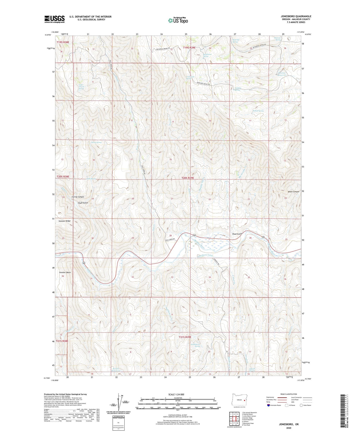
2023 topographic map quadrangle Jonesboro in the state of Oregon. Scale: 1:24000. Based on the newly updated USGS 7.5' US Topo map series, this map is in the following counties: Malheur. The map contains contour data, water features, and other items you are used to seeing on USGS maps, but also has updated roads and other features. This is the next generation of topographic maps. Printed on high-quality waterproof paper with UV fade-resistant inks.
Quads adjacent to this one:
West: Stemler Ridge
Northwest: De Armond Mountain
North: Westfall Butte
Northeast: Little Black Canyon
East: South Mountain
Southeast: Tims Peak
South: Monument Peak
Southwest: Juntura
This map covers the same area as the classic USGS quad with code o43117g8.
Contains the following named places: Antelope Spring, Big Swamp Creek, Black Canyon, Bristol Reservoir, Buckboard Spring, Butterfly Spring, Calf Creek, Chalk Gulch, Chalk Spring, Cherry Spring, Currey Canyon, D Jones Ranch, Deadhorse Creek, Dipping Vat Creek, Indian Creek, Jonesboro, Jonesboro Canal, Peach, Peavine Reservoir, Pine Creek, Pole Creek, Road Gulch, Saddlehorse Creek, Saddlehorse Spring, Sidehill Spring, South Trail Creek, Trail Creek, Trail Creek Spring, Upper Cherry Spring, Vaughn Peach Ranch, Willow Spring