MyTopo
Steins Pillar Oregon US Topo Map
Couldn't load pickup availability
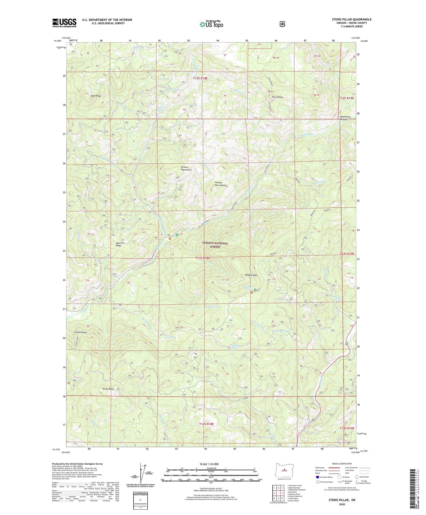
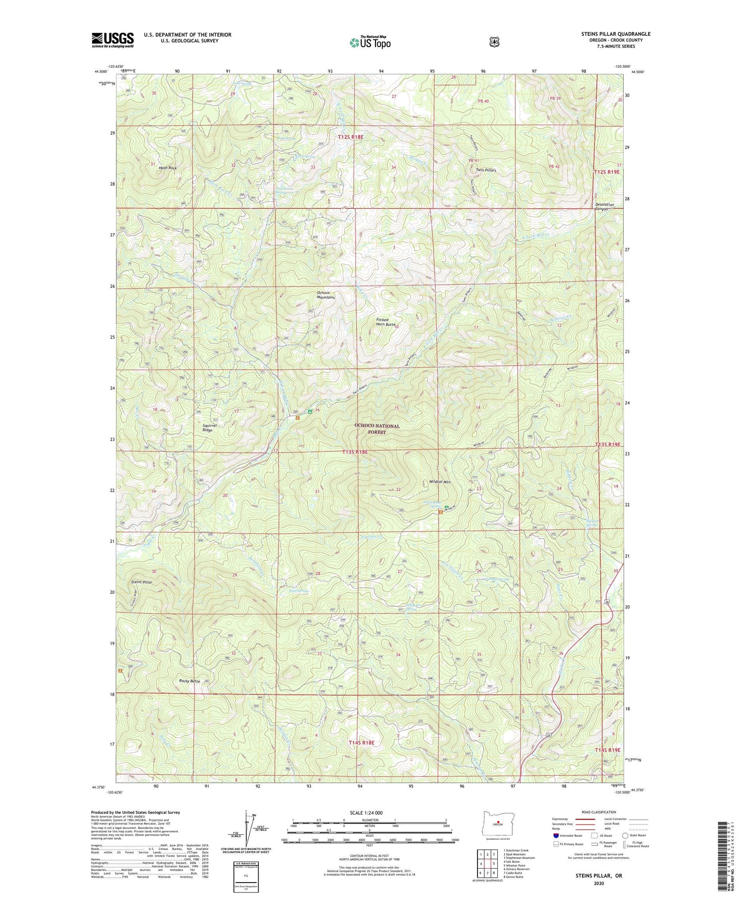
2020 topographic map quadrangle Steins Pillar in the state of Oregon. Scale: 1:24000. Based on the newly updated USGS 7.5' US Topo map series, this map is in the following counties: Crook. The map contains contour data, water features, and other items you are used to seeing on USGS maps, but also has updated roads and other features. This is the next generation of topographic maps. Printed on high-quality waterproof paper with UV fade-resistant inks.
Quads adjacent to this one:
West: Salt Butte
Northwest: Dutchman Creek
North: Opal Mountain
Northeast: Stephenson Mountain
East: Whistler Point
Southeast: Gerow Butte
South: Cadle Butte
Southwest: Ochoco Reservoir
Contains the following named places: Barney, Barney Post Office, Belknap Creek, Benefield Creek, Brogan Creek, Cayuse Forest Camp, Desolation Canyon, Doe Creek, Dorn Spring, East Fork Mill Creek, Fintcher Creek, Forked Horn Butte, Harvey Creek, Hash Rock, Hash Rock Creek, Hawthorne Spring, Jackson Spring, Jesse Spring, Jim Elliott Creek, King Spring, Lakin Place, Lemon Creek, Mill Creek Wilderness, Prineville Division, Riley Creek, Rock Spring, Rocky Butte, Sears Creek, Squirrel Ridge, Steins Pillar, Swamp Spring, Twin Pillars, West Fork Mill Creek, White Fir Spring, White Rock Recreation Site, White Rock Spring, Wildcat Mountain, Wildcat Recreation Site