MyTopo
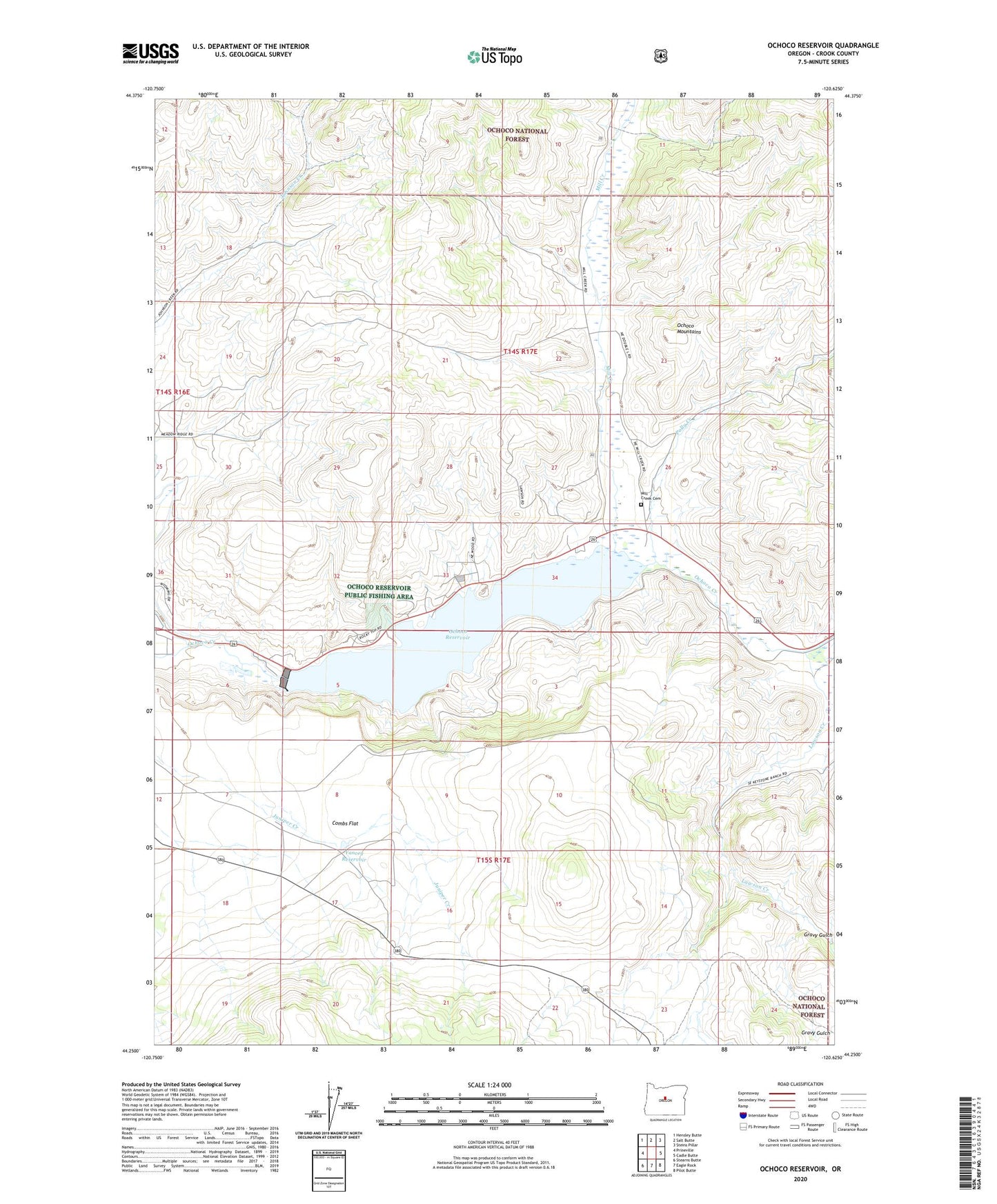
Ochoco Reservoir Oregon US Topo Map
Couldn't load pickup availability
Also explore the Ochoco Reservoir Forest Service Topo of this same quad for updated USFS data
2024 topographic map quadrangle Ochoco Reservoir in the state of Oregon. Scale: 1:24000. Based on the newly updated USGS 7.5' US Topo map series, this map is in the following counties: Crook. The map contains contour data, water features, and other items you are used to seeing on USGS maps, but also has updated roads and other features. This is the next generation of topographic maps. Printed on high-quality waterproof paper with UV fade-resistant inks.
Quads adjacent to this one:
West: Prineville
Northwest: Hensley Butte
North: Salt Butte
Northeast: Steins Pillar
East: Cadle Butte
Southeast: Pilot Butte
South: Eagle Rock
Southwest: Stearns Butte
This map covers the same area as the classic USGS quad with code o44120c6.
Contains the following named places: Combs Flat, Gravy Gulch, Lawson Creek, Mill Creek, Mill Creek Cemetery, Mill Creek School, Ochocco Lake County Park Boat Ramp, Ochoco Dam, Ochoco Lake State Park, Ochoco Reservoir, Ochoco Reservoir Public Fishing Area, Polly Creek, Upper Ochoco Post Office, Yancey Reservoir