
MyTopo
Taft Mountain Oregon US Topo Map
Couldn't load pickup availability
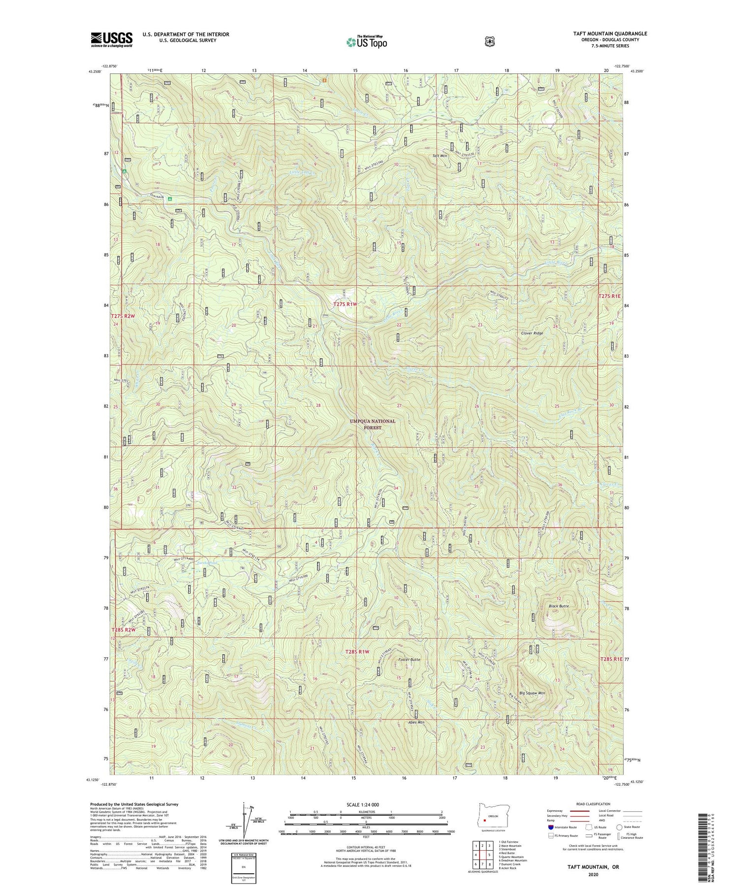
2020 topographic map quadrangle Taft Mountain in the state of Oregon. Scale: 1:24000. Based on the newly updated USGS 7.5' US Topo map series, this map is in the following counties: Douglas. The map contains contour data, water features, and other items you are used to seeing on USGS maps, but also has updated roads and other features. This is the next generation of topographic maps. Printed on high-quality waterproof paper with UV fade-resistant inks.
Quads adjacent to this one:
West: Red Butte
Northwest: Old Fairview
North: Mace Mountain
Northeast: Steamboat
East: Quartz Mountain
Southeast: Acker Rock
South: Dumont Creek
Southwest: Deadman Mountain
Contains the following named places: Abes Mountain, Big Squaw Mountain, Black Butte, Black Creek, Camp Grant, Clover Creek, Clover Ridge, Coolwater Recreation Site, Emile Shelter Recreation Site, Eureka Pond, Flat Rock Branch, Foster Butte, Little Taft Creek, Negro Creek, Peter Paul Prairie, Poore Creek, Red Butte Trail, Sunset Shelter, Taft Creek, Taft Mountain, White Creek, White Creek Recreation Site


