MyTopo
Quartz Mountain Oregon US Topo Map
Couldn't load pickup availability
Also explore the Quartz Mountain Forest Service Topo of this same quad for updated USFS data
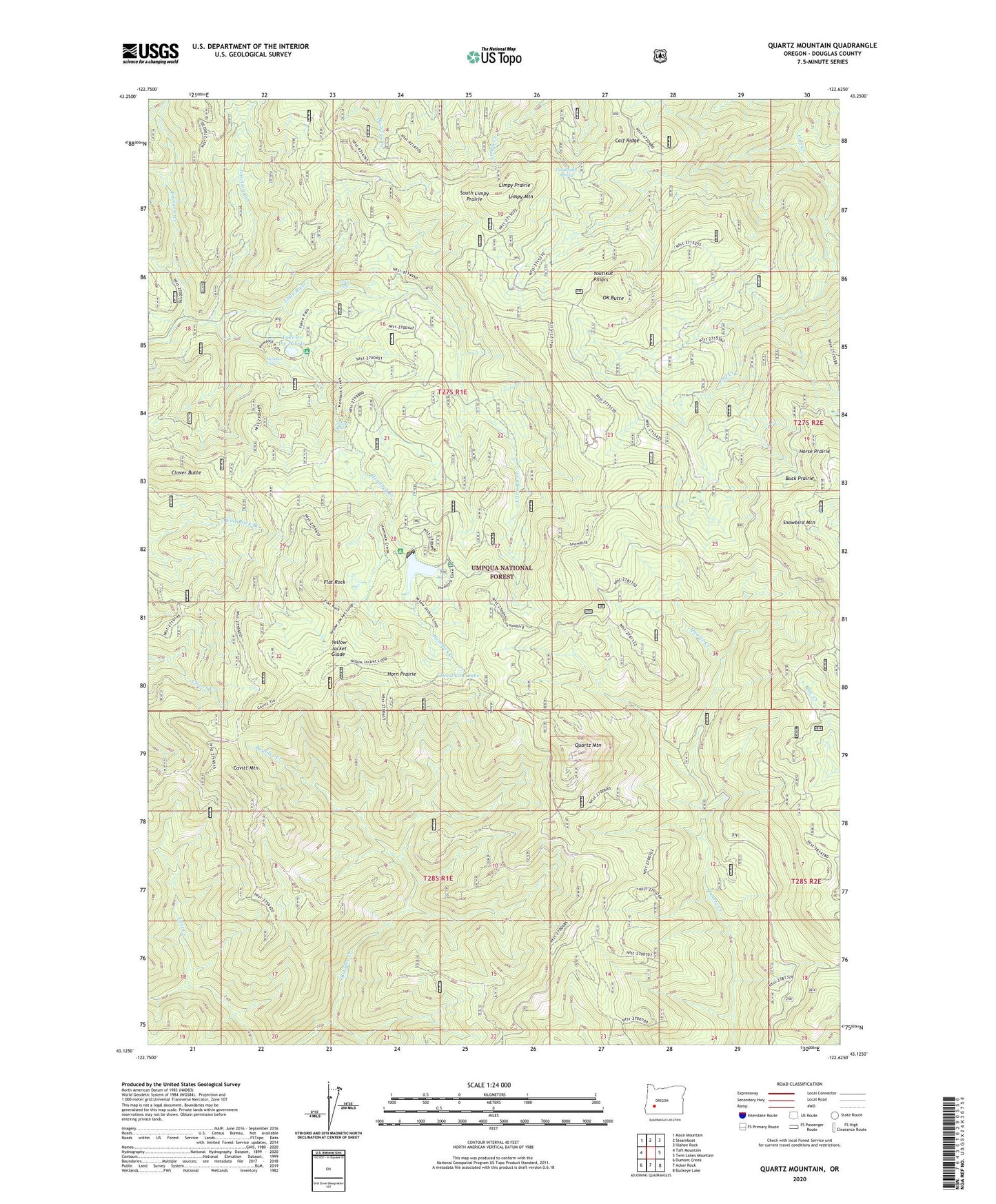
2024 topographic map quadrangle Quartz Mountain in the state of Oregon. Scale: 1:24000. Based on the newly updated USGS 7.5' US Topo map series, this map is in the following counties: Douglas. The map contains contour data, water features, and other items you are used to seeing on USGS maps, but also has updated roads and other features. This is the next generation of topographic maps. Printed on high-quality waterproof paper with UV fade-resistant inks.
Quads adjacent to this one:
West: Taft Mountain
Northwest: Mace Mountain
North: Steamboat
Northeast: Illahee Rock
East: Twin Lakes Mountain
Southeast: Buckeye Lake
South: Acker Rock
Southwest: Dumont Creek
This map covers the same area as the classic USGS quad with code o43122b6.
Contains the following named places: Buck Prairie, Buckhead Mountain Campground, Buckhead Trail, Calf Ridge, Cavitt Mountain, Cinderella Spring, Clover Butte, Clover Falls, Dead Cow Lake, Flat Rock, Harpham Lake, Hemlock Creek, Hemlock Falls, Hemlock Lake, Hemlock Lake Boat Ramp, Hemlock Lake Recreation Site, Hemlock Meadows Dam, Hemlock Meadows Recreation Site, Horn Prairie, Horse Prairie, Junction Creek, Lake in the Woods, Lake in the Woods Boat Ramp, Lake in the Woods Recreation Site, Limpy Mountain, Limpy Prairie, OK Butte, Pinnacle Creek, Quartz Mountain, Quartz Mountain Guard Station, Snowbird Mountain, Snowbird Shelter, South Limpy Prairie, Twin Lake Creek, Yakso Falls, Yellow Jacket Glade, Youtlkut Pillars