MyTopo
Mace Mountain Oregon US Topo Map
Couldn't load pickup availability
Also explore the Mace Mountain Forest Service Topo of this same quad for updated USFS data
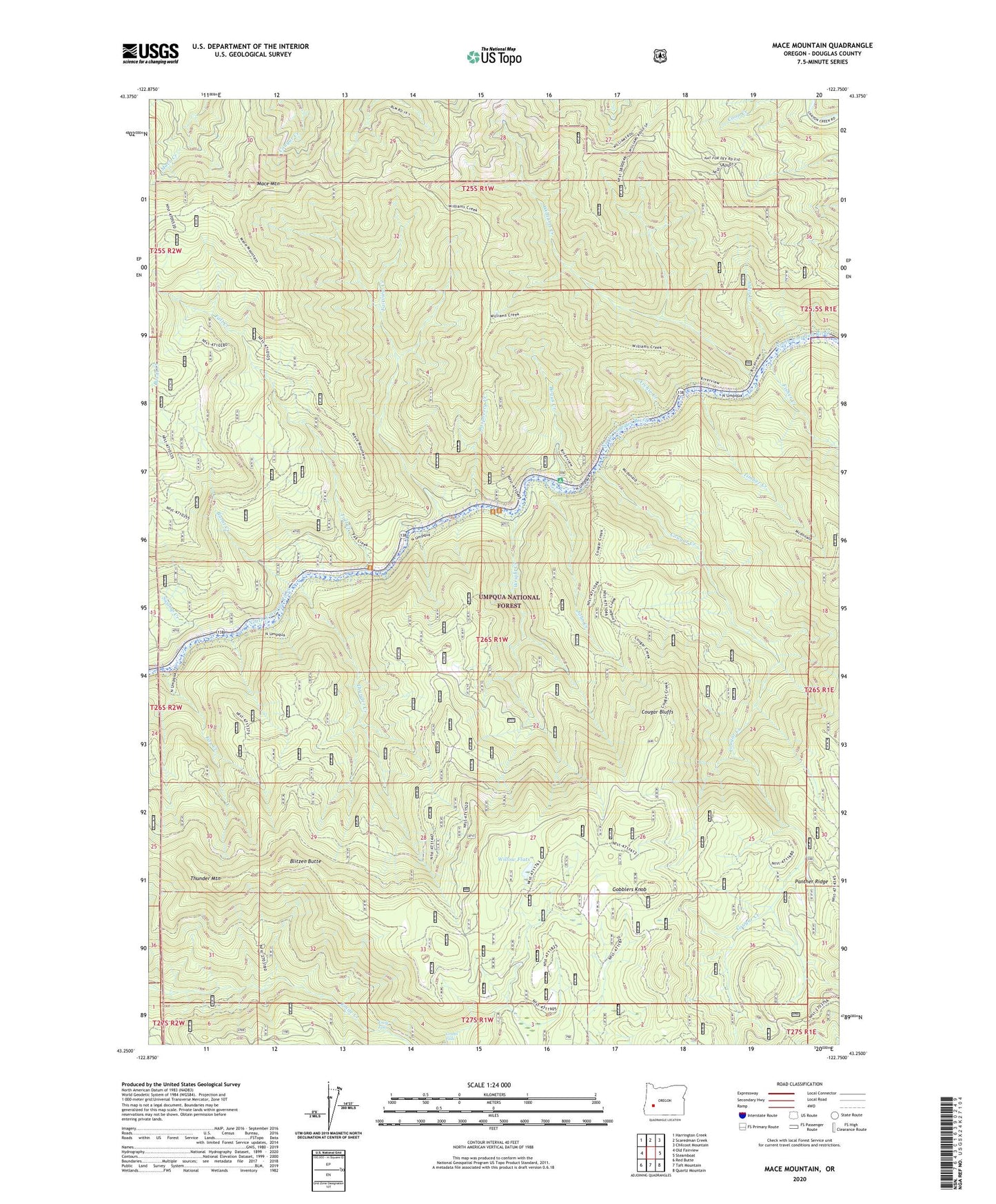
2024 topographic map quadrangle Mace Mountain in the state of Oregon. Scale: 1:24000. Based on the newly updated USGS 7.5' US Topo map series, this map is in the following counties: Douglas. The map contains contour data, water features, and other items you are used to seeing on USGS maps, but also has updated roads and other features. This is the next generation of topographic maps. Printed on high-quality waterproof paper with UV fade-resistant inks.
Quads adjacent to this one:
West: Old Fairview
Northwest: Harrington Creek
North: Scaredman Creek
Northeast: Chilcoot Mountain
East: Steamboat
Southeast: Quartz Mountain
South: Taft Mountain
Southwest: Red Butte
This map covers the same area as the classic USGS quad with code o43122c7.
Contains the following named places: Alder Creek, Archie Creek, Blitzen Butte, Bogus Creek, Bogus Creek Recreation Site, Burnt Creek, Cougar Bluffs, Cougar Creek, Emile Falls, Fairview Creek, Fall Creek, Fall Creek Recreation Site, Fisher Creek, Fox Creek, Gobblers Knob, Grotto Falls, Jobs Garden, John Creek, Mace Mountain, Mott Trail, Raspberry Creek, Swamp Creek, Thunder Creek, Thunder Mountain, Thunder Mountain Trail, Timber Creek, Williams Creek, Williams Creek Recreation Site, Williams Creek Trail, Willow Flats, Willow Flats Recreation Site, Wright Creek