MyTopo
Mount Isabelle Oregon US Topo Map
Couldn't load pickup availability
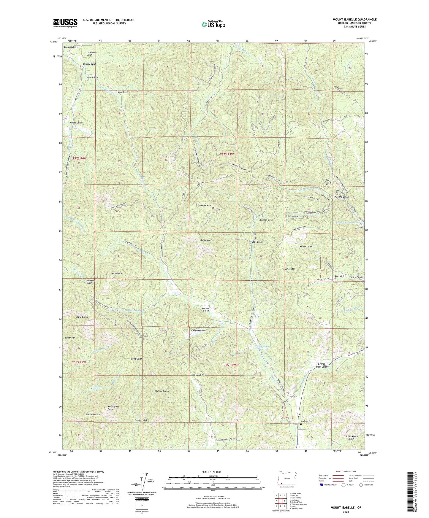
2023 topographic map quadrangle Mount Isabelle in the state of Oregon. Scale: 1:24000. Based on the newly updated USGS 7.5' US Topo map series, this map is in the following counties: Jackson. The map contains contour data, water features, and other items you are used to seeing on USGS maps, but also has updated roads and other features. This is the next generation of topographic maps. Printed on high-quality waterproof paper with UV fade-resistant inks.
Quads adjacent to this one:
West: Applegate
Northwest: Rogue River
North: Gold Hill
Northeast: Sams Valley
East: Medford West
Southeast: Sterling Creek
South: Ruch
Southwest: Tallowbox Mountain
This map covers the same area as the classic USGS quad with code o42123c1.
Contains the following named places: Baldy Mountain, Black, Brushy Gulch, Bunny Meadows, Cantrall Creek, Deadhorse Spring, Draper, Draper Post Office, East Branch Galls Creek, George Black Gulch, Herling Post Office, Horn Gulch, Jacksonville Dam, Jacksonville Reservoir, Left Fork Foots Creek, Lennox Gulch, Lilly Prairie, Log Town Cemetery, Lonesome Gulch, Lucky Boy Mine, Lyons Gulch, Marshall Gulch, Max Gulch, Middle Fork Foots Creek, Miller Mountain, Moore Gulch, Mount Isabelle, Norling Gulch, One Horse Town, Oregon Belle Creek, Oregon Belle Mine, Panther Gulch, Poormans Creek, Rail Gulch, Right Fork Forest Creek, Rock Gulch, Sailor Gulch, Sturgis Mine, Sugarloaf, Timber Mountain, Wellington Butte, West Branch Galls Creek, Winningham Reservoir