MyTopo
Frog Hollow Oregon US Topo Map
Couldn't load pickup availability
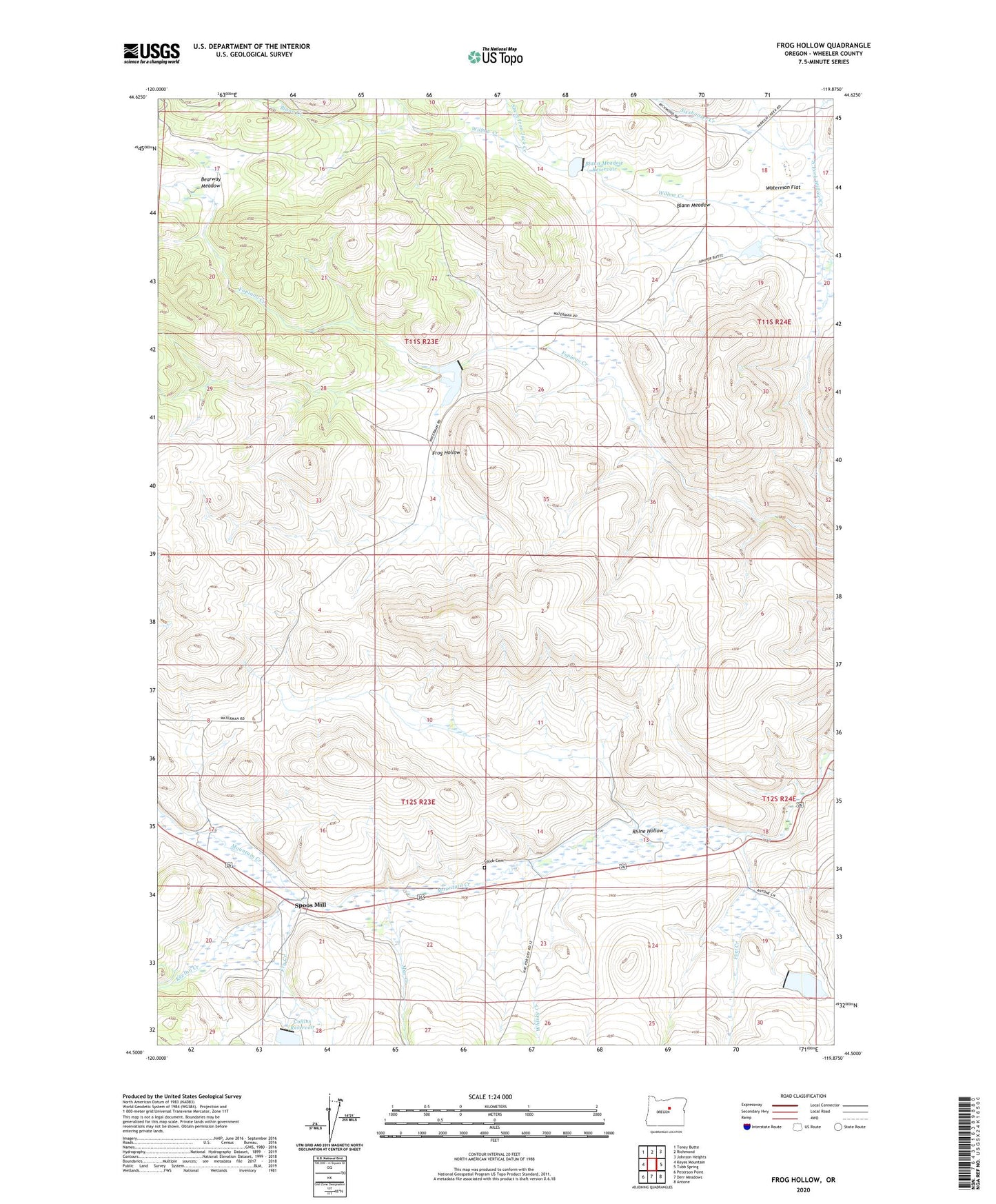
2023 topographic map quadrangle Frog Hollow in the state of Oregon. Scale: 1:24000. Based on the newly updated USGS 7.5' US Topo map series, this map is in the following counties: Wheeler. The map contains contour data, water features, and other items you are used to seeing on USGS maps, but also has updated roads and other features. This is the next generation of topographic maps. Printed on high-quality waterproof paper with UV fade-resistant inks.
Quads adjacent to this one:
West: Keyes Mountain
Northwest: Toney Butte
North: Richmond
Northeast: Johnson Heights
East: Tubb Spring
Southeast: Antone
South: Derr Meadows
Southwest: Peterson Point
This map covers the same area as the classic USGS quad with code o44119e8.
Contains the following named places: Bearway Meadow, Blann Creek, Blann Meadow, Blann Meadow Reservoir, Blann Meadow Reservoir Dam, Caleb, Caleb Cemetery, Caleb Post Office, Collins Dam, Collins Landing Strip, Collins Reservoir, Dry Lake, Fopiano Dam, Fopiano Ranch, Fopiano Reservoir, Fort Creek, Fort Creek Dam, Fort Creek Reservoir, Frog Hollow, Fry Creek, Keeton Creek, Mac Creek, McKay Creek, North Fork Willow Creek, One-Oh-One Ranch, Rhine Hollow, Sheet Iron Jack Creek, Sixshooter Creek, Spoos Mill, Waterman, Waterman Flat, Waterman Post Office, Whisky Creek