MyTopo
Turner Oregon US Topo Map
Couldn't load pickup availability
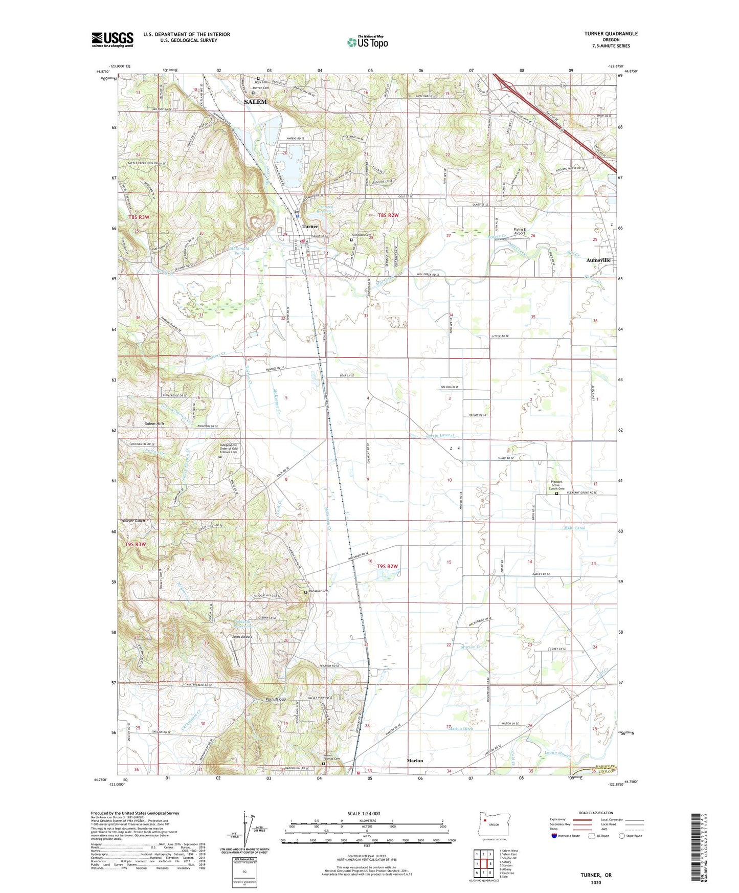
2023 topographic map quadrangle Turner in the state of Oregon. Scale: 1:24000. Based on the newly updated USGS 7.5' US Topo map series, this map is in the following counties: Marion, Linn. The map contains contour data, water features, and other items you are used to seeing on USGS maps, but also has updated roads and other features. This is the next generation of topographic maps. Printed on high-quality waterproof paper with UV fade-resistant inks.
Quads adjacent to this one:
West: Sidney
Northwest: Salem West
North: Salem East
Northeast: Stayton NE
East: Stayton
Southeast: Scio
South: Crabtree
Southwest: Albany
This map covers the same area as the classic USGS quad with code o44122g8.
Contains the following named places: Aldersgate Conference Center, Ames Airport, Aumsville Elementary School, Aumsville Public Works Department, Battle Creek, Beaver Creek, Boys Cemetery, Cascade Junior High School, Cascade Senior High School, City of Turner, Cloverdale Elementary School, Cook Creek, Crandall, Flying E Airport, Franzen Dam, Franzen Reservoir, Herren Cemetery, Hunsaker Cemetery, Independent Order of Odd Fellows Cemetery, Jefferson Division, Main Canal, Marion Census Designated Place, Marion Ditch, Marion Friends Cemetery, McDonald Pond, McKinney Creek, North Fork Norton Creek, North Santiam, North Santiam School, Norton Creek, Parrish Gap, Perrin Lateral, Pleasant Grove - Condit Cemetery, Pleasant Grove Church, Porter Boone Park, Porter Creek, Rodgers Creek, Salem Water Treatment Plant, Seclusia Reservoir, Shaw Creek, South Fork Norton Creek, Stayton Rural Fire Protection District Marion Station, Turner, Turner Christian Church, Turner City Hall, Turner Elementary School, Turner Fire Department, Turner Municipal Court, Turner Police Department, Turner Post Office, Turner Public Works Department Office, Twin Oaks Cemetery, West Stayton School, ZIP Code: 97392