MyTopo
Vale West Oregon US Topo Map
Couldn't load pickup availability
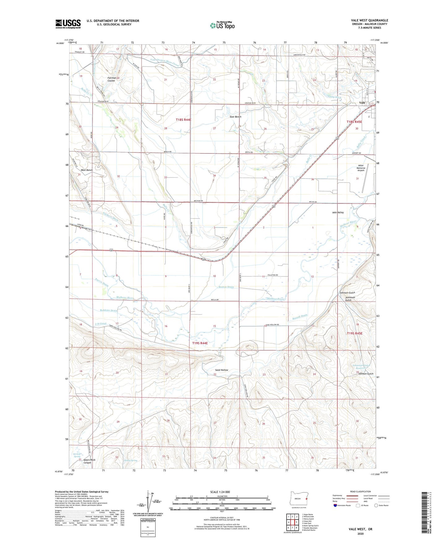
2023 topographic map quadrangle Vale West in the state of Oregon. Scale: 1:24000. Based on the newly updated USGS 7.5' US Topo map series, this map is in the following counties: Malheur. The map contains contour data, water features, and other items you are used to seeing on USGS maps, but also has updated roads and other features. This is the next generation of topographic maps. Printed on high-quality waterproof paper with UV fade-resistant inks.
Quads adjacent to this one:
West: Vines Hill
Northwest: Hope Butte
North: Willowcreek
Northeast: Henry Gulch
East: Vale East
Southeast: Mitchell Butte
South: Double Mountain
Southwest: Kane Spring Gulch
This map covers the same area as the classic USGS quad with code o43117h3.
Contains the following named places: Boston Drain, Bully Creek Siphon, East Bench, Fairman Coulee, Farmers Ditch, Grove City Post Office, Hickey Spring, Hope, Hope School, Jamieson Gulch, J-H Canal, Johnson Gulch, Johnston Gulch Reservoir, Lateral 197, Miller Memorial Airpark, Negro Rock Canyon, Oil Well Spring, Paris, Pump Ditch, Purvis Drain, Robbins Drain, Russell Drain, Sand Hollow, Vale Fire and Ambulance, Vale High School, Vale Oregon Main Canal, West Bench Division