MyTopo
Vinson Oregon US Topo Map
Couldn't load pickup availability
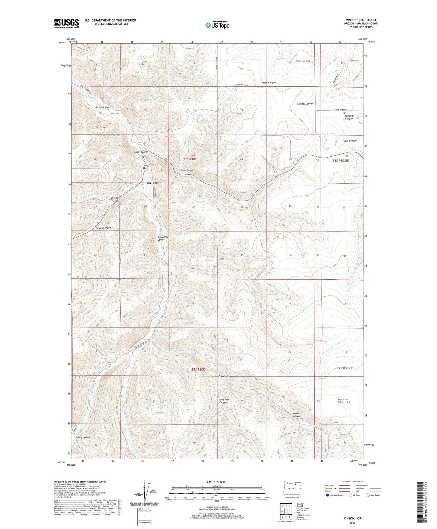
2024 topographic map quadrangle Vinson in the state of Oregon. Scale: 1:24000. Based on the newly updated USGS 7.5' US Topo map series, this map is in the following counties: Umatilla. The map contains contour data, water features, and other items you are used to seeing on USGS maps, but also has updated roads and other features. This is the next generation of topographic maps. Printed on high-quality waterproof paper with UV fade-resistant inks.
Quads adjacent to this one:
West: Franklin Hill
Northwest: Echo SW
North: Echo SE
Northeast: Coombs Canyon
East: Nye
Southeast: Carney Butte
South: Gurdane
Southwest: Hoodlum Canyon
This map covers the same area as the classic USGS quad with code o45119d1.
Contains the following named places: Butter Creek, Carney Canyon, Dry Hog Hollow, East Fork Butter Creek, Evarts Post Office, Hog Hollow, Kramer Canyon, Lone Pine Canyon, Nelson Canyon, Rancheree Canyon, Roberts Canyon, Spring Hollow, Vinson, Vinson Canyon, Vinson Cemetery, Vinson Post Office, Webb Slough