MyTopo
Nye Oregon US Topo Map
Couldn't load pickup availability
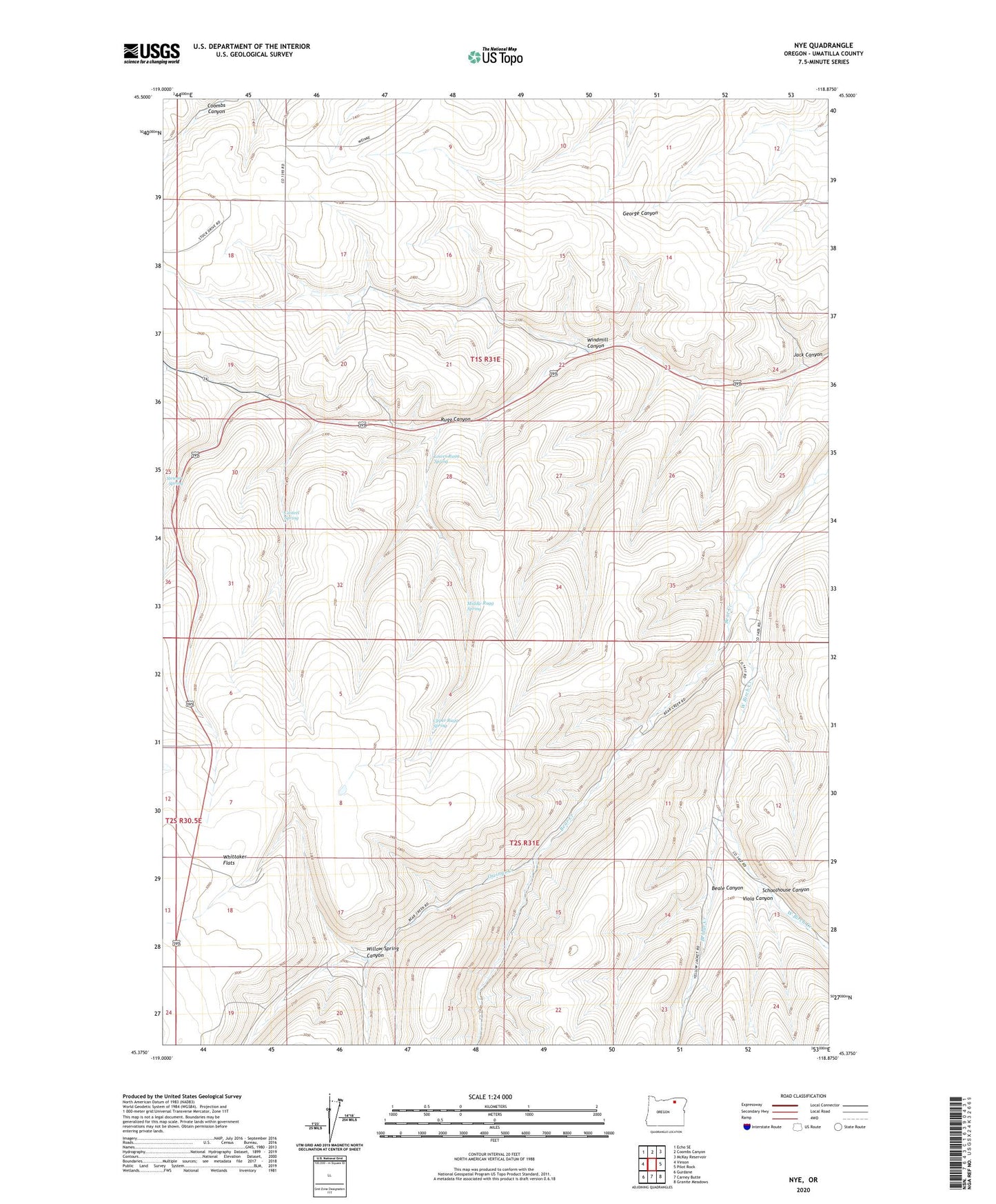
2023 topographic map quadrangle Nye in the state of Oregon. Scale: 1:24000. Based on the newly updated USGS 7.5' US Topo map series, this map is in the following counties: Umatilla. The map contains contour data, water features, and other items you are used to seeing on USGS maps, but also has updated roads and other features. This is the next generation of topographic maps. Printed on high-quality waterproof paper with UV fade-resistant inks.
Quads adjacent to this one:
West: Vinson
Northwest: Echo SE
North: Coombs Canyon
Northeast: McKay Reservoir
East: Pilot Rock
Southeast: Granite Meadows
South: Carney Butte
Southwest: Gurdane
This map covers the same area as the classic USGS quad with code o45118d8.
Contains the following named places: Beale Canyon, Bear Creek, Bill Howell Dam, Bridge Creek, Casteel Spring, Lower Rugg Spring, Middle Rugg Spring, Nye, Nye Post Office, Owings Creek, Rugg Canyon, Schoolhouse Canyon, Stewart Spring, Upper Rugg Spring, Viola Canyon, Whittaker Flats, Willow Spring Canyon, Windmill Canyon