MyTopo
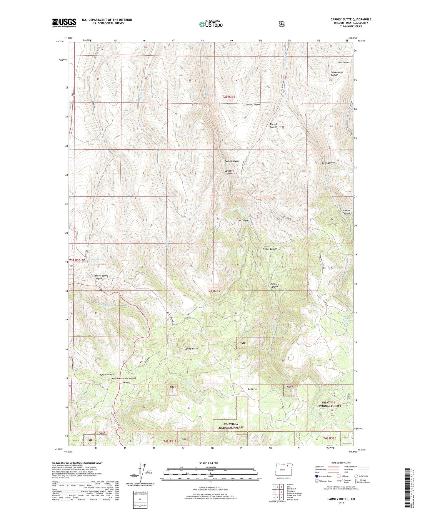
Carney Butte Oregon US Topo Map
Couldn't load pickup availability
Also explore the Carney Butte Forest Service Topo of this same quad for updated USFS data
2023 topographic map quadrangle Carney Butte in the state of Oregon. Scale: 1:24000. Based on the newly updated USGS 7.5' US Topo map series, this map is in the following counties: Umatilla. The map contains contour data, water features, and other items you are used to seeing on USGS maps, but also has updated roads and other features. This is the next generation of topographic maps. Printed on high-quality waterproof paper with UV fade-resistant inks.
Quads adjacent to this one:
West: Gurdane
Northwest: Vinson
North: Nye
Northeast: Pilot Rock
East: Granite Meadows
Southeast: Owens Butte
South: Ukiah
Southwest: Sugarbowl Creek
This map covers the same area as the classic USGS quad with code o45118c8.
Contains the following named places: Arlie Canyon, Battle Mountain Forest State Park, Battle Mountain Forest State Scenic Corridor, Battle Mountain State Park, Battle Mountain Summit, Campbell Canyon, Carney Butte, Keen Canyon, Mountain Home, Parker Canyon, Pedro Canyon, Ridenor Canyon, Robinson Canyon, Swiss Flat, Tinroof Canyon, Willow Spring, Yellow Jacket Spring