MyTopo
Warm Springs Reservoir Oregon US Topo Map
Couldn't load pickup availability
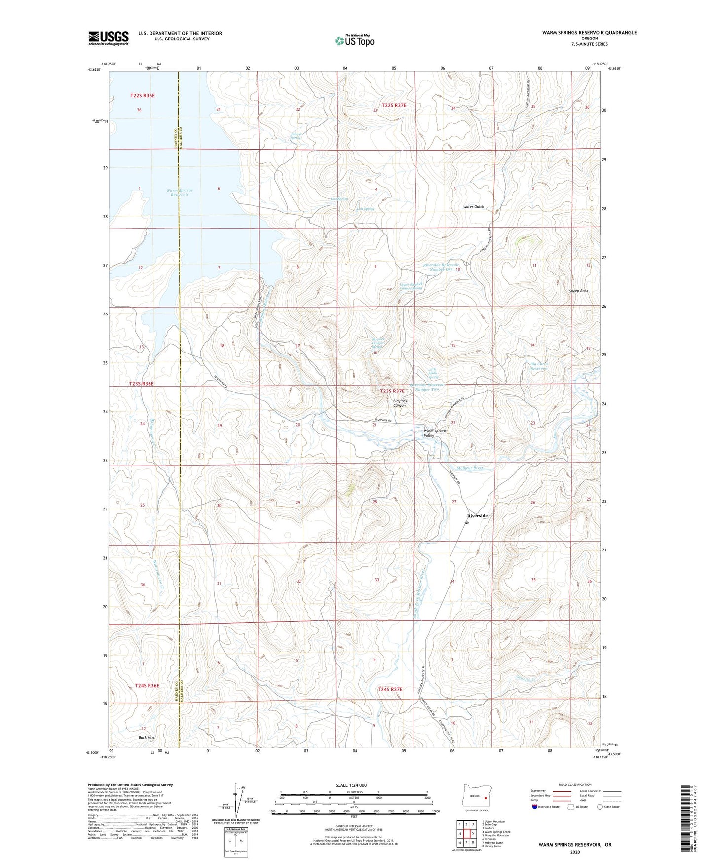
2024 topographic map quadrangle Warm Springs Reservoir in the state of Oregon. Scale: 1:24000. Based on the newly updated USGS 7.5' US Topo map series, this map is in the following counties: Malheur, Harney. The map contains contour data, water features, and other items you are used to seeing on USGS maps, but also has updated roads and other features. This is the next generation of topographic maps. Printed on high-quality waterproof paper with UV fade-resistant inks.
Quads adjacent to this one:
West: Warm Springs Creek
Northwest: Upton Mountain
North: Selle Gap
Northeast: Juntura
East: Mosquito Mountain
Southeast: Hickey Basin
South: McEwen Butte
Southwest: Dunnean
This map covers the same area as the classic USGS quad with code o43118e2.
Contains the following named places: Big Curve Reservoir, Blaylock Canyon, Blaylock Canyon Spring, Granite Creek, Juniper Canyon, Juniper Spring, Kool Spring, Little Alkali Spring, Lost Spring, Middle Warm Springs Reservoir Boat Ramp, Riverside, Riverside Post Office, Riverside Reservoir Number One, Riverside Reservoir Number Two, Sheep Rock, South Fork Malheur River, Upper Blaylock Canyon Spring, Warm Springs Dam, Warm Springs Reservoir, Warm Springs Reservoir Boat Landing South, Warm Springs Valley, Winnemucca Creek