MyTopo
Spray Oregon US Topo Map
Couldn't load pickup availability
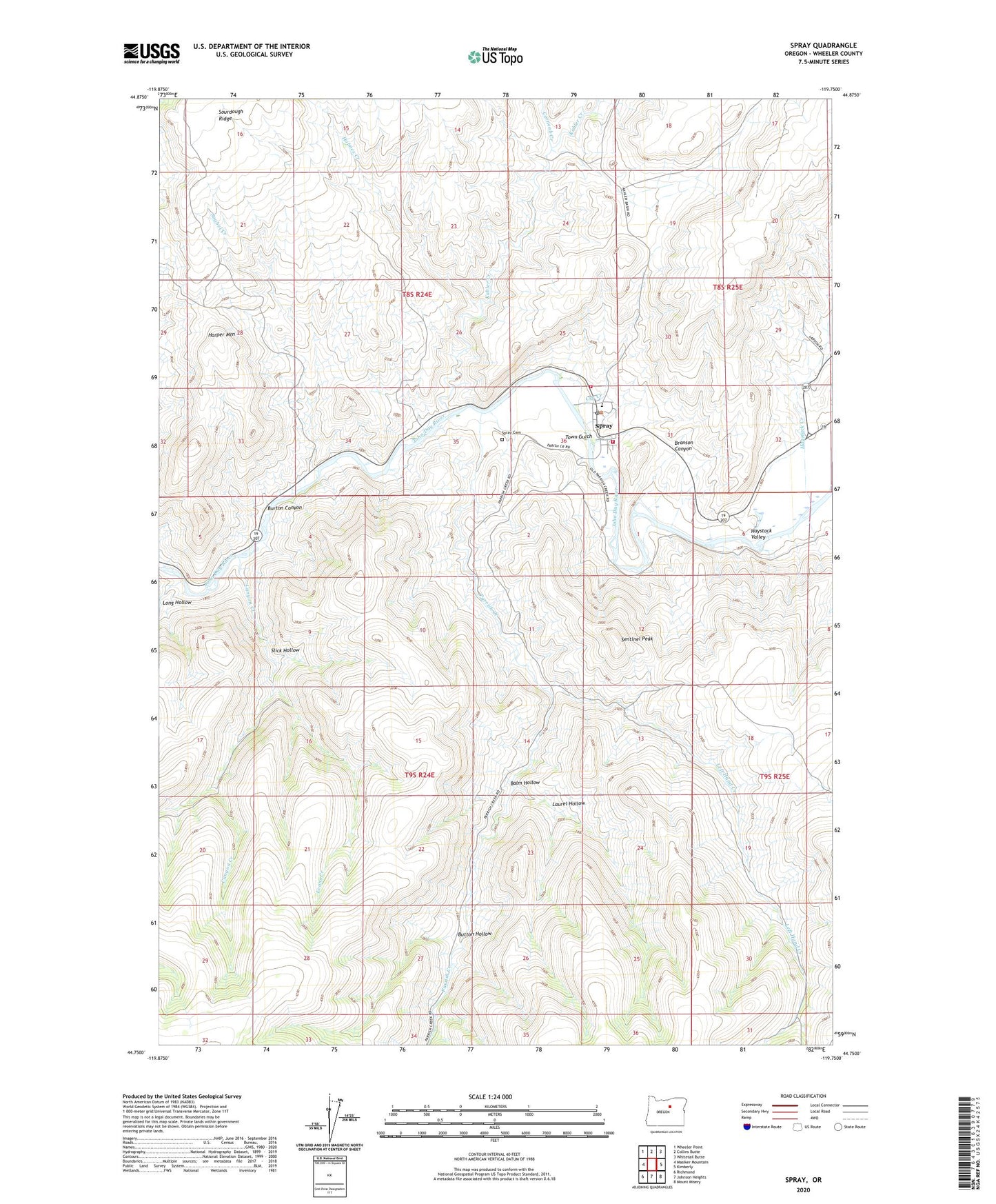
2023 topographic map quadrangle Spray in the state of Oregon. Scale: 1:24000. Based on the newly updated USGS 7.5' US Topo map series, this map is in the following counties: Wheeler. The map contains contour data, water features, and other items you are used to seeing on USGS maps, but also has updated roads and other features. This is the next generation of topographic maps. Printed on high-quality waterproof paper with UV fade-resistant inks.
Quads adjacent to this one:
West: Masiker Mountain
Northwest: Wheeler Point
North: Collins Butte
Northeast: Whitetail Butte
East: Kimberly
Southeast: Mount Misery
South: Johnson Heights
Southwest: Richmond
This map covers the same area as the classic USGS quad with code o44119g7.
Contains the following named places: Balm Hollow, Branson Canyon, Burton Canyon, Button Hollow, Canyon Creek, Corncob Creek, Cry Creek, Evans Creek, Harper Mountain, Haystack Creek, Haystack Valley, Holmes Creek, Kahler Creek, Laurel Hollow, Left Hand Creek, Long Hollow, Parrish Creek, Poplar Post Office, Sentinel Peak, Slick Hollow, Snabel Creek, Spray, Spray Airstrip, Spray Boat Access Site, Spray Cemetery, Spray City Hall, Spray Pioneer Museum, Spray Post Office, Spray Public Works Road Department, Spray Riverfront Park, Spray Rodeo Grounds, Spray School, Spray School Public Library, Spray Sewage Treatment Plant, Spray Volunteer Ambulance Association, Spray Volunteer Fire Department, Town Gulch, Town of Spray, ZIP Code: 97874