MyTopo
Amity Pennsylvania US Topo Map
Couldn't load pickup availability
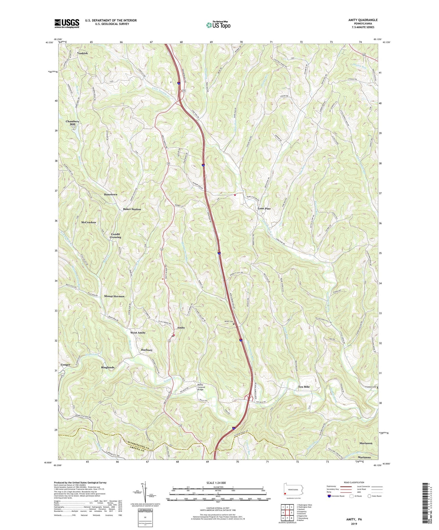
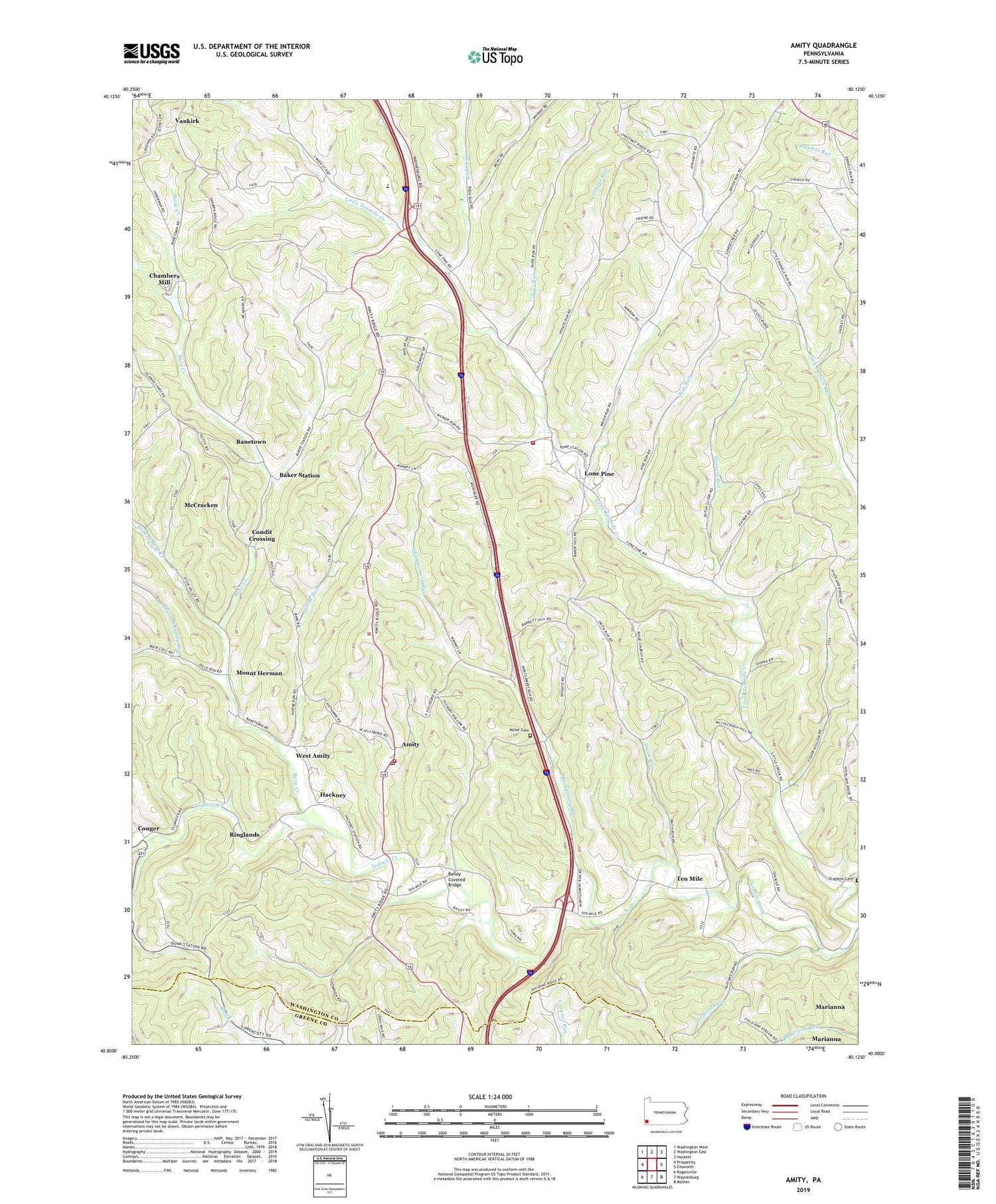
2019 topographic map quadrangle Amity in the state of Pennsylvania. Scale: 1:24000. Based on the newly updated USGS 7.5' US Topo map series, this map is in the following counties: Washington, Greene. The map contains contour data, water features, and other items you are used to seeing on USGS maps, but also has updated roads and other features. This is the next generation of topographic maps. Printed on high-quality waterproof paper with UV fade-resistant inks.
Quads adjacent to this one:
West: Prosperity
Northwest: Washington West
North: Washington East
Northeast: Hackett
East: Ellsworth
Southeast: Mather
South: Waynesburg
Southwest: Rogersville
Contains the following named places: Amity, Amity Post Office, Amity School, Amwell Township Volunteer Fire Department Station 34, Bailey Covered Bridge, Baker Station, Bakers, Bane Creek, Banetown, Bethlehem Church, Bissell, Brush Run, Chambers, Chambers Dam, Chambers Mill, Chambers Reservoir, Condit Crossing, Conger, Dunns Station, Fork of Bane Creek, Franklin Cemetery, Hackney, Hainers Run, Harts Mill, Horne Run, Hufford Run, Kathys Day Care Center, Liberty Church, Little Tenmile Creek, Lone Pine, Lone Pine School, Lone Pine Volunteer Fire Department Station 50, Long Pine, Luellen Station, McCracken, Miller Cemetery, Montgomery Run, Moore Shaft, Mount Herman, Nolton Station, North Tenmile Church, Pine Run, Pleasant Hill Church, Pleasant Valley Run, Potato Run, Redd Run, Ringlands, Shipe Run, Smith Run, Sowers School, Strabane Post Office, Ten Mile, Township of Amwell, Union Sunday School, Vankirk, West Amity, ZIP Code: 15311