MyTopo
Tremont Pennsylvania US Topo Map
Couldn't load pickup availability
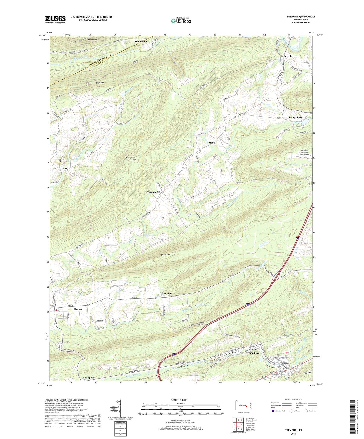
2023 topographic map quadrangle Tremont in the state of Pennsylvania. Scale: 1:24000. Based on the newly updated USGS 7.5' US Topo map series, this map is in the following counties: Schuylkill, Northumberland. The map contains contour data, water features, and other items you are used to seeing on USGS maps, but also has updated roads and other features. This is the next generation of topographic maps. Printed on high-quality waterproof paper with UV fade-resistant inks.
Quads adjacent to this one:
West: Valley View
Northwest: Shamokin
North: Mount Carmel
Northeast: Ashland
East: Minersville
Southeast: Swatara Hill
South: Pine Grove
Southwest: Tower City
This map covers the same area as the classic USGS quad with code o40076f4.
Contains the following named places: Beury Lake, Beurys Lake, Beurys Lake Census Designated Place, Borough of Tremont, Coal Run, Crab Run, Dell Lake, Donaldson, Donaldson Census Designated Place, Donaldson Fire Company District 12 Station 1, Fountain, Haas, Hans Yost Creek, Hegins, Hegins Census Designated Place, Hegins Fire Company District 13 Station 1, Helfenstein, Hinkel Farms, I-81 Scenic View, Klingers School, Lake View Park, Lamberton, Little Mountain, Mabel, Middle Creek, Poplar Creek, Red Mountain, Saint John Church, Salem Church, Taylorville, Township of Barry, Township of Eldred, Township of Frailey, Tremont, Tremont Area Ambulance, Tremont Elementary School, Tremont Fire Company District 67 Station 1, Tremont Police Department, Tremont Post Office, Union Church, Weishample, West Schuylkill Advanced Life Support, Zion Church, ZIP Code: 17981